ملف:Satellite image of Philippines in March 2002.jpg
حجم هذه المعاينة: 460 × 600 بكسل. البعدان الآخران: 1٬570 × 2٬048 بكسل | 4٬600 × 6٬000 بكسل.
الملف الأصلي (4٬600 × 6٬000 بكسل حجم الملف: 3٫58 ميجابايت، نوع MIME: image/jpeg)
وصف قصير
| ⧼wm-license-information-description⧽ |
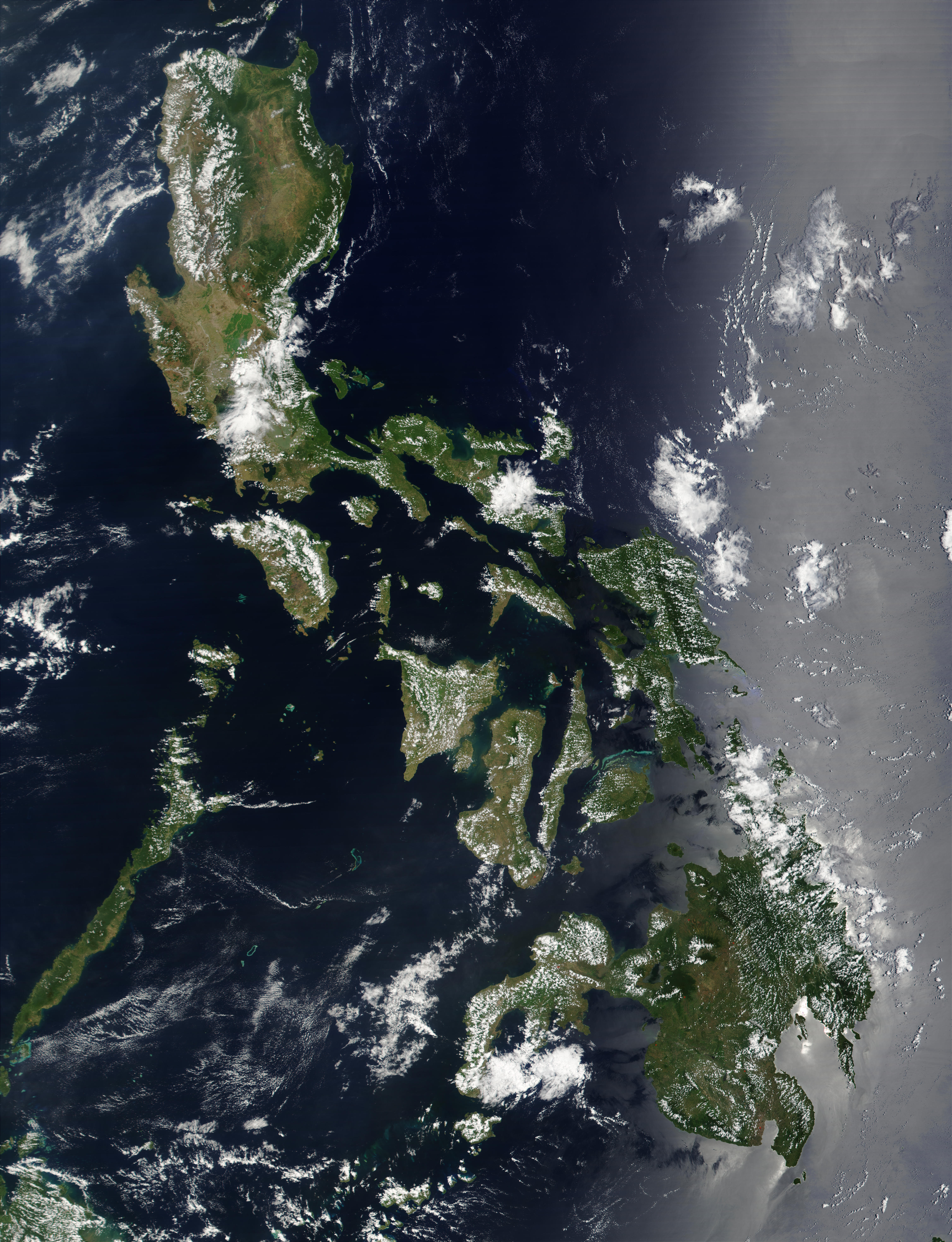
Satellite image of Philippines in March 2002. |
| ⧼wm-license-information-date⧽ | 2002 |
| ⧼wm-license-information-source⧽ | http://visibleearth.nasa.gov/view_rec.php?id=2689 |
| ⧼wm-license-information-author⧽ | NASA |
ترخيص
تاريخ الملف
اضغط على زمن/تاريخ لرؤية الملف كما بدا في هذا الزمن.
| زمن/تاريخ | صورة مصغرة | الأبعاد | مستخدم | تعليق | |
|---|---|---|---|---|---|
| حالي | ★ مراجعة معتمدة 05:30، 26 يناير 2024 | | 4٬600 × 6٬000 (3٫58 ميجابايت) | Pastakhov (نقاش | مساهمات) | Upload https://upload.wikimedia.org/wikipedia/commons/5/54/Satellite_image_of_Philippines_in_March_2002.jpg |
لا يمكنك استبدال هذا الملف.
وصلات
لا يوجد صفحات تصل لهذه الصورة.