ملف:Satellite image of Denmark in July 2001.jpg
حجم هذه المعاينة: 800 × 596 بكسل. البعد الآخر: 1٬905 × 1٬420 بكسل.
الملف الأصلي (1٬905 × 1٬420 بكسل حجم الملف: 190 كيلوبايت، نوع MIME: image/jpeg)
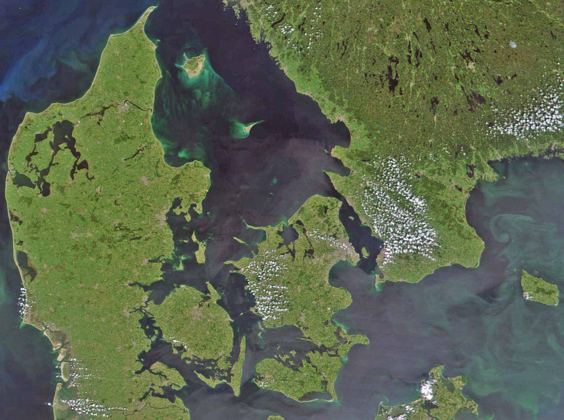
Satellite image of Denmark in July 2001. Cropped image, original taken from NASA's Visible Earth http://visibleearth.nasa.gov/view_rec.php?id=1909
- Interestingly, the Danish-German border is incorrectly placed. The line shown on the map has the correct shape, but is located c. 10 kilometres south of the current border. The line should have been positioned between the islands Rømø and Sylt in the west, and through the fjord to the east. Valentinian (talk) 17:09, 12 November 2006 (UTC)
تاريخ الملف
اضغط على زمن/تاريخ لرؤية الملف كما بدا في هذا الزمن.
| زمن/تاريخ | صورة مصغرة | الأبعاد | مستخدم | تعليق | |
|---|---|---|---|---|---|
| حالي | ★ مراجعة معتمدة 01:12، 16 يناير 2024 | | 1٬905 × 1٬420 (190 كيلوبايت) | Pastakhov (نقاش | مساهمات) | Upload https://upload.wikimedia.org/wikipedia/commons/6/60/Satellite_image_of_Denmark_in_July_2001.jpg |
لا يمكنك استبدال هذا الملف.
وصلات
لا يوجد صفحات تصل لهذه الصورة.