ملف:Satellite image of Bir Tawil.jpg
حجم هذه المعاينة: 800 × 396 بكسل. البعد الآخر: 4٬031 × 1٬996 بكسل.
الملف الأصلي (4٬031 × 1٬996 بكسل حجم الملف: 1٫23 ميجابايت، نوع MIME: image/jpeg)
وصف قصير
| ⧼wm-license-information-description⧽ |
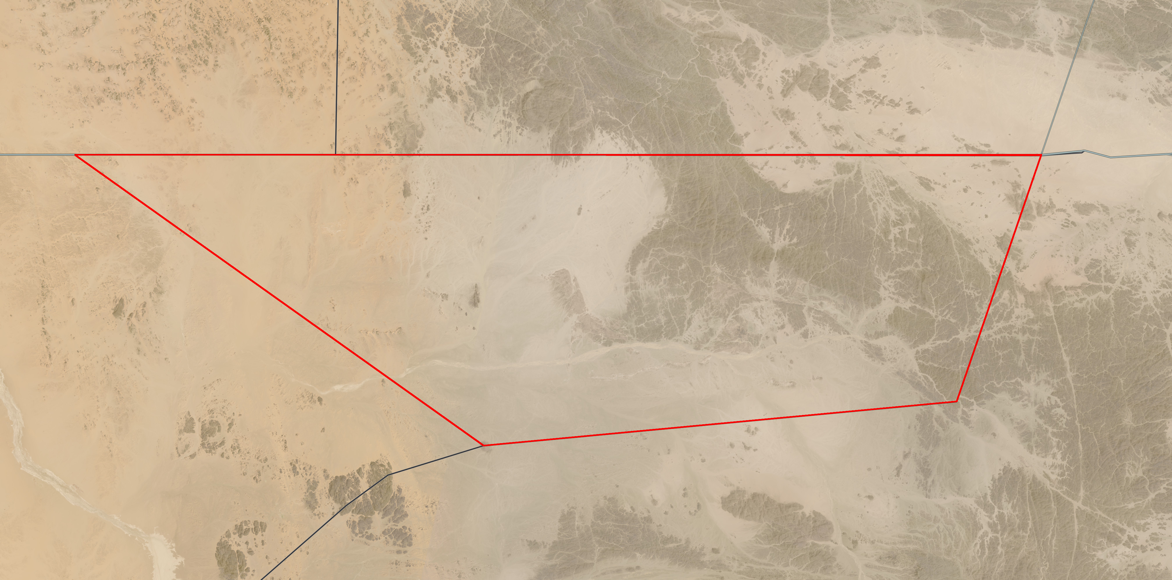
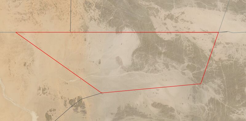
English: Satellite image of Bir Tawil (highlighted in red), a Terra nullius between Egypt and Sudan. This image is composed of two satellite images, one taken on March 29, and another taken on April 5.
(Portuguese) |
| ⧼wm-license-information-date⧽ | between 2021 and 2021 |
| ⧼wm-license-information-source⧽ | https://worldview.earthdata.nasa.gov/?v=32.55626092826267,21.355252631649694,34.600300491074385,22.35704493821523&l=Reference_Labels(hidden),Reference_Features(hidden),Coastlines(hidden),HLS_L30_Nadir_BRDF_Adjusted_Reflectance,MODIS_Combined_L3_Nadir-BRDF_Daily(hidden),VIIRS_NOAA20_CorrectedReflectance_TrueColor(hidden),VIIRS_SNPP_CorrectedReflectance_TrueColor(hidden),MODIS_Aqua_CorrectedReflectance_TrueColor(hidden),MODIS_Terra_CorrectedReflectance_TrueColor(hidden)&lg=false&t=2021-04-05-T19%3A13%3A59Z |
| ⧼wm-license-information-author⧽ | Landsat 8 / OLI |
ترخيص
تاريخ الملف
اضغط على زمن/تاريخ لرؤية الملف كما بدا في هذا الزمن.
| زمن/تاريخ | صورة مصغرة | الأبعاد | مستخدم | تعليق | |
|---|---|---|---|---|---|
| حالي | ★ مراجعة معتمدة 02:08، 13 أكتوبر 2023 | | 4٬031 × 1٬996 (1٫23 ميجابايت) | Pastakhov (نقاش | مساهمات) | Upload https://upload.wikimedia.org/wikipedia/commons/2/2e/Satellite_image_of_Bir_Tawil.jpg |
لا يمكنك استبدال هذا الملف.
وصلات
لا يوجد صفحات تصل لهذه الصورة.