ملف:San Juan Islands map.png
حجم هذه المعاينة: 546 × 600 بكسل. البعد الآخر: 784 × 861 بكسل.
الملف الأصلي (784 × 861 بكسل حجم الملف: 504 كيلوبايت، نوع MIME: image/png)
وصف قصير
| ⧼wm-license-information-description⧽ |
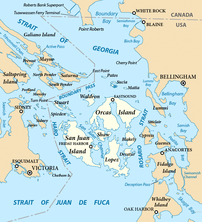
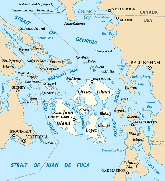
English: Map of the San Juan Islands (highlighted) and surrounding region. Created with ArcExplorer and Adobe Illustrator. Based on on GeoBase and The National Map data. Map projection: Washington State Plane North (State Plane Coordinate System).
|
| ⧼wm-license-information-date⧽ | 2011 |
| ⧼wm-license-information-source⧽ | ⧼Wm-license-own-work⧽ |
| ⧼wm-license-information-author⧽ | Pfly |
| ⧼wm-license-information-other-versions⧽ |
|
ترخيص
|

تاريخ الملف
اضغط على زمن/تاريخ لرؤية الملف كما بدا في هذا الزمن.
| زمن/تاريخ | صورة مصغرة | الأبعاد | مستخدم | تعليق | |
|---|---|---|---|---|---|
| حالي | ★ مراجعة معتمدة 17:04، 17 أكتوبر 2023 | | 784 × 861 (504 كيلوبايت) | Pastakhov (نقاش | مساهمات) | Upload https://upload.wikimedia.org/wikipedia/commons/e/e1/San_Juan_Islands_map.png |
لا يمكنك استبدال هذا الملف.
وصلات
لا يوجد صفحات تصل لهذه الصورة.