ملف:Saint-Louis Haut-Rhin map-fr.svg

حجم معاينة PNG لذلك الملف ذي الامتداد SVG: 517 × 600 بكسل. البعد الآخر: 1٬765 × 2٬048 بكسل.
الملف الأصلي (ملف SVG، أبعاده 2٬143 × 2٬486 بكسل، حجم الملف: 344 كيلوبايت)
وصف قصير
| ⧼wm-license-information-description⧽ |
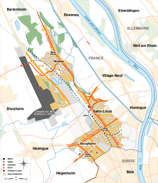
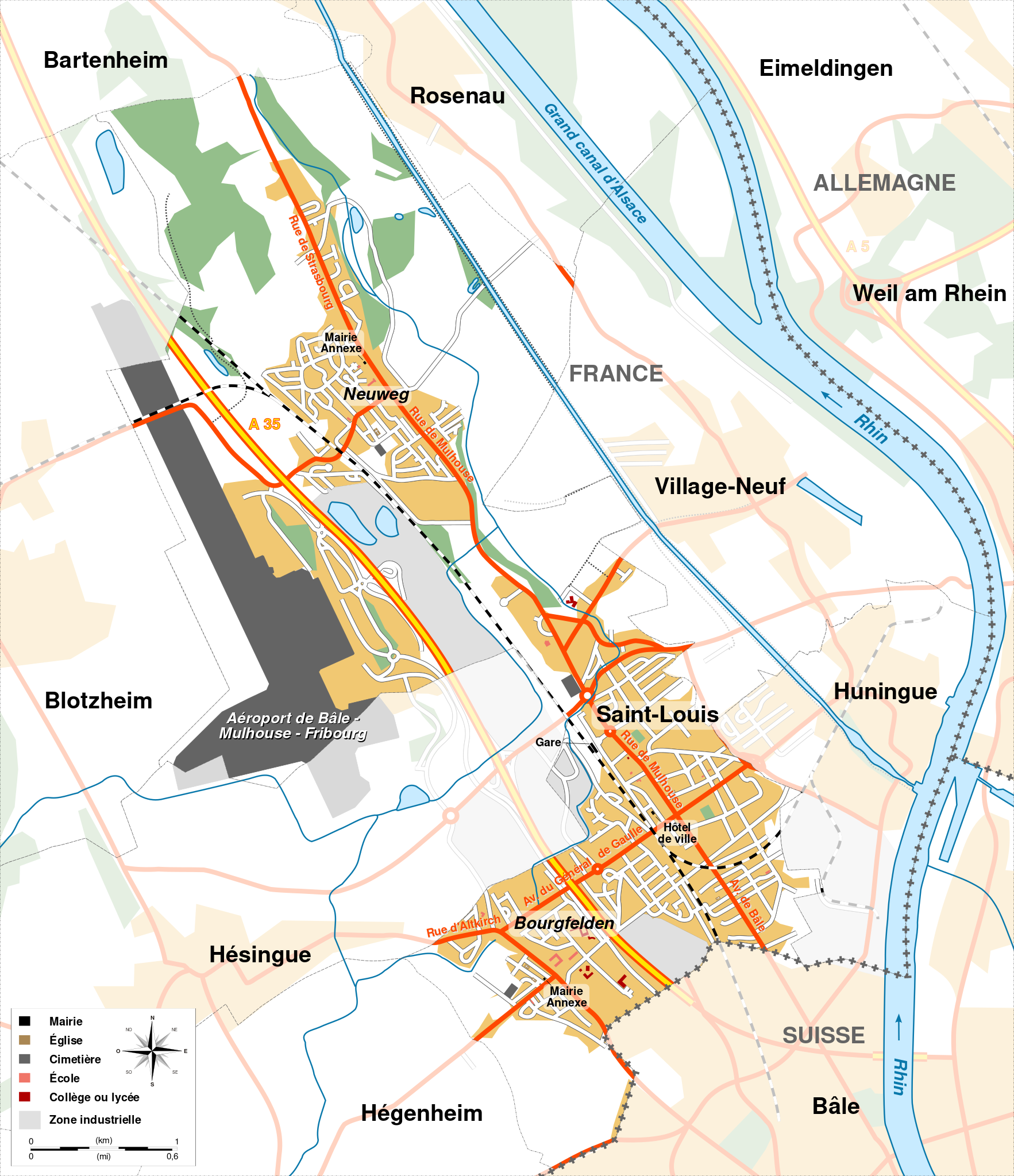
قالب:Multilingual description/start English: Map of Saint-Louis, Alsace, France.
Français : Carte de Saint-Louis, Alsace, France.
|
||
| ⧼wm-license-information-date⧽ | 2008 | ||
| ⧼wm-license-information-source⧽ |
|
||
| ⧼wm-license-information-author⧽ | Sémhur | ||
| ⧼wm-license-information-other-versions⧽ | |||
| SVG |
قالب:ValidSVG
|
||
| Graphic Lab | قالب:Atelier graphique carte |
ترخيص
تاريخ الملف
اضغط على زمن/تاريخ لرؤية الملف كما بدا في هذا الزمن.
| زمن/تاريخ | صورة مصغرة | الأبعاد | مستخدم | تعليق | |
|---|---|---|---|---|---|
| حالي | ★ مراجعة معتمدة 11:32، 13 ديسمبر 2023 | | 2٬143 × 2٬486 (344 كيلوبايت) | Pastakhov (نقاش | مساهمات) | Upload https://upload.wikimedia.org/wikipedia/commons/b/b1/Saint-Louis_Haut-Rhin_map-fr.svg |
لا يمكنك استبدال هذا الملف.
وصلات
لا يوجد صفحات تصل لهذه الصورة.