ملف:SARS map.svg

حجم معاينة PNG لذلك الملف ذي الامتداد SVG: 800 × 406 بكسل. البعد الآخر: 2٬560 × 1٬299 بكسل.
الملف الأصلي (ملف SVG، أبعاده 940 × 477 بكسل، حجم الملف: 1٫28 ميجابايت)
| ⧼wm-license-information-description⧽ |
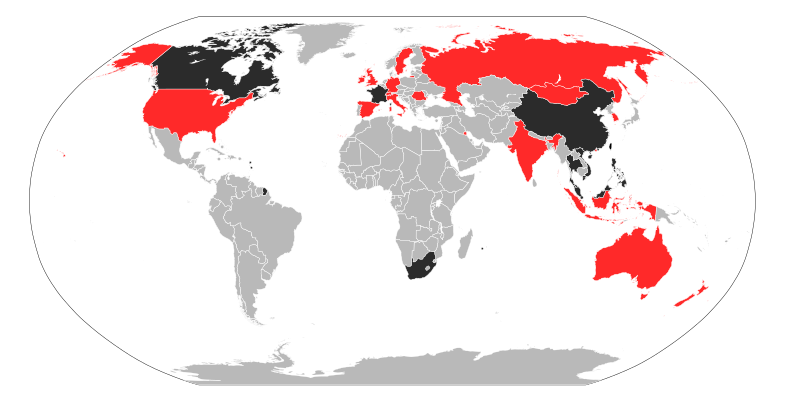
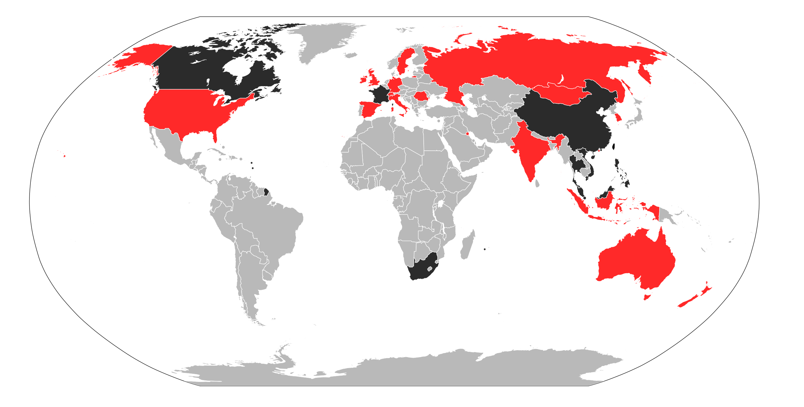
Deutsch: Karte der von der SARS-Epidemie im Zeitraum 01.11.2002 - 07.08.2003 betroffenen Staaten.
Staaten mit bestätigten Todesfällen
Staaten mit bestätigten Infektionen
Staaten ohne bestätigte SARS-Fälle English: A map of the infected countries of the epidemic of SARS between 2002-11-01 and 2003-08-07.
Countries with confirmed deaths
Countries with confirmed infections
Countries without confirmed cases |
|||
| ⧼wm-license-information-date⧽ | data is from 2008-08-15, the map is from 2009-06-09 | |||
| ⧼wm-license-information-source⧽ | self made, using this map and this data from the WHO | |||
| ⧼wm-license-information-author⧽ | Maximilian Dörrbecker (Chumwa) | |||
| ⧼wm-license-information-permission⧽ (⧼wm-license-information-permission-reusing-text⧽) |
|

تاريخ الملف
اضغط على زمن/تاريخ لرؤية الملف كما بدا في هذا الزمن.
| زمن/تاريخ | صورة مصغرة | الأبعاد | مستخدم | تعليق | |
|---|---|---|---|---|---|
| حالي | ★ مراجعة معتمدة 00:11، 15 أكتوبر 2023 | | 940 × 477 (1٫28 ميجابايت) | Pastakhov (نقاش | مساهمات) | Upload https://upload.wikimedia.org/wikipedia/commons/c/c6/SARS_map.svg |
لا يمكنك استبدال هذا الملف.
وصلات
لا يوجد صفحات تصل لهذه الصورة.