ملف:Russian Federation (orthographic projection) - All Territorial Disputes.svg

حجم معاينة PNG لذلك الملف ذي الامتداد SVG: 536 × 537 بكسل. البعد الآخر: 2٬044 × 2٬048 بكسل.
الملف الأصلي (ملف SVG، أبعاده 536 × 537 بكسل، حجم الملف: 442 كيلوبايت)
وصف قصير
| ⧼wm-license-information-description⧽ |
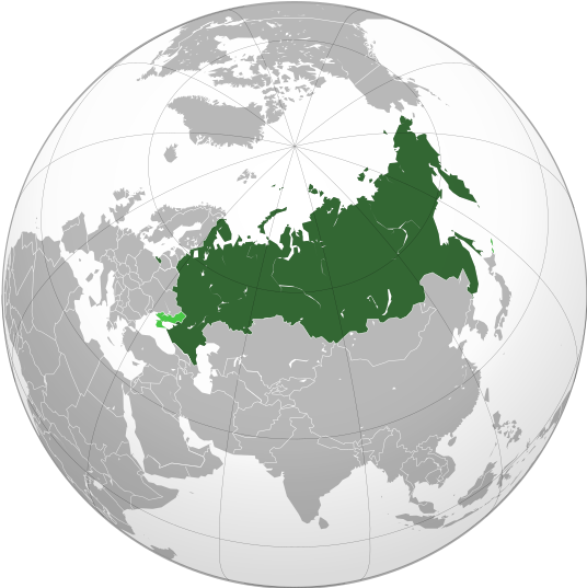
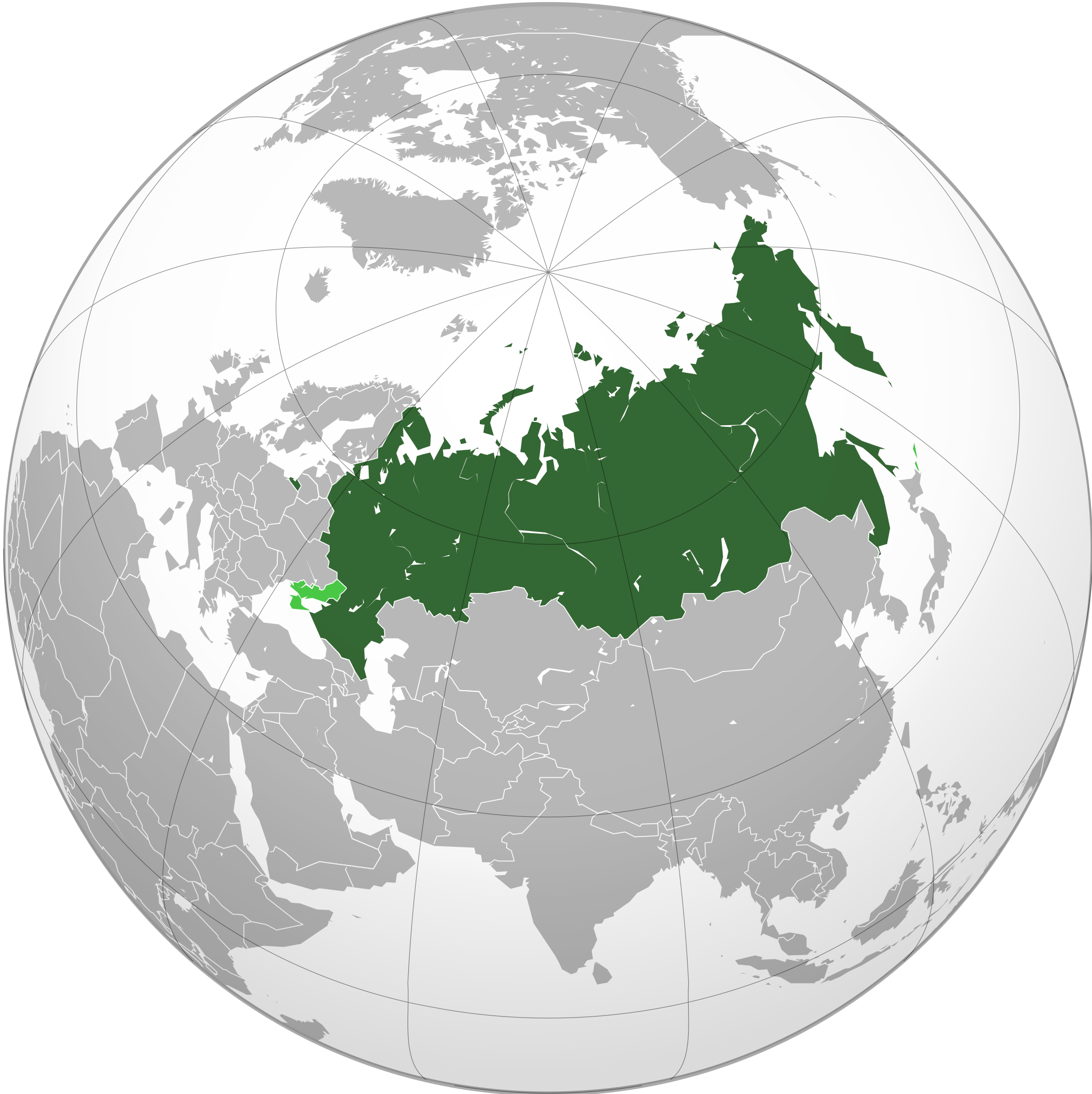
English: Map of Russia with all disputed/claimed territories (in Ukraine and Kuril Islands) marked in light green.
|
| ⧼wm-license-information-date⧽ | 2023 |
| ⧼wm-license-information-source⧽ | ⧼Wm-license-own-work⧽ |
| ⧼wm-license-information-author⧽ | Jamie Eilat |
| ⧼wm-license-information-other-versions⧽ |
|
ترخيص
|
تاريخ الملف
اضغط على زمن/تاريخ لرؤية الملف كما بدا في هذا الزمن.
| زمن/تاريخ | صورة مصغرة | الأبعاد | مستخدم | تعليق | |
|---|---|---|---|---|---|
| حالي | ★ مراجعة معتمدة 19:37، 30 أكتوبر 2023 | | 536 × 537 (442 كيلوبايت) | Pastakhov (نقاش | مساهمات) | Upload https://upload.wikimedia.org/wikipedia/commons/5/5e/Russian_Federation_%28orthographic_projection%29_-_All_Territorial_Disputes.svg |
لا يمكنك استبدال هذا الملف.
وصلات
لا يوجد صفحات تصل لهذه الصورة.
_-_All_Territorial_Disputes.svg&oldid=3306997)