ملف:Rockall Plateau and Trough, NE Atlantic.png
لا توجد دقة أعلى متوفرة.
Rockall_Plateau_and_Trough,_NE_Atlantic.png (413 × 323 بكسل حجم الملف: 295 كيلوبايت، نوع MIME: image/png)
| ⧼wm-license-information-description⧽ |
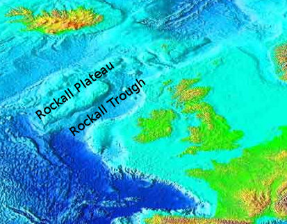
English: Northeast Atlantic bathymetry with Rockall Plateau and Trough labelled.
|
| ⧼wm-license-information-date⧽ | 2008-09-29 04:13 (UTC) |
| ⧼wm-license-information-source⧽ | |
| ⧼wm-license-information-author⧽ |
|
| [This is a retouched picture, which means that it has been digitally altered from its original version. Modifications: Cropped and labelled. The original can be viewed here: Atlantic_bathymetry.jpg. Modifications made by CIreland.] Error: {{Lang}}: text has italic markup (help)
|

|
قالب:Original upload log
This image is a derivative work of the following images:
- Image:Atlantic_bathymetry.jpg licensed with PD-USGov-NOAA
- 2006-11-27T19:20:12Z Korrigan 1825x2000 (460592 Bytes) Rétablissement de la version précédente
- 2006-11-14T11:21:54Z Ludo29 547x599 (99161 Bytes) The Atlantic Ocean. Source: http://www.ngdc.noaa.gov/mgg/image/2minrelief.html Récupéré depuis Wikipédia:en avec le même nom
- 2006-03-15T02:08:29Z Interiot 1825x2000 (460592 Bytes) change framing
- 2006-03-15T02:03:51Z Interiot 1491x2000 (380502 Bytes) == Summary == The Atlantic Ocean. Source: http://www.ngdc.noaa.gov/mgg/image/2minrelief.html == Licensing == {{PD-USGov}} [[Category:Ocean topography]]
تاريخ الملف
اضغط على زمن/تاريخ لرؤية الملف كما بدا في هذا الزمن.
| زمن/تاريخ | صورة مصغرة | الأبعاد | مستخدم | تعليق | |
|---|---|---|---|---|---|
| حالي | ★ مراجعة معتمدة 23:11، 19 أكتوبر 2023 | | 413 × 323 (295 كيلوبايت) | Pastakhov (نقاش | مساهمات) | Upload https://upload.wikimedia.org/wikipedia/commons/b/bd/Rockall_Plateau_and_Trough%2C_NE_Atlantic.png |
لا يمكنك استبدال هذا الملف.
وصلات
لا يوجد صفحات تصل لهذه الصورة.