ملف:Rock of Cashel, Tipperary.jpg
حجم هذه المعاينة: 800 × 514 بكسل. البعد الآخر: 1٬024 × 658 بكسل.
الملف الأصلي (1٬024 × 658 بكسل حجم الملف: 826 كيلوبايت، نوع MIME: image/jpeg)
| ⧼wm-license-information-description⧽ |
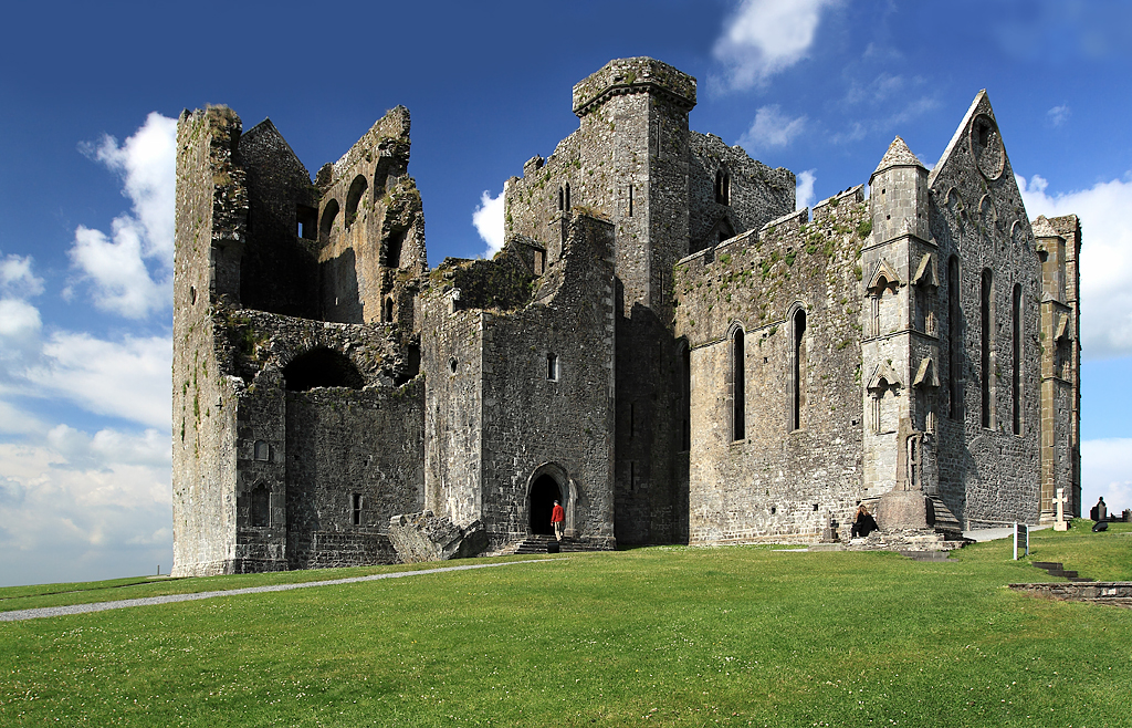
English: Rock of Cashel, Tipperary, Munster, Ireland.
The view is of the cathedral and its attached castle on the Rock of Cashel. From the earliest of times, and before these buildings were erected, what is now the cathedral close was always a fortress. It was then the seat of Brian Boru, crowned High King of Ireland in 977, but in 1101 it was handed over to the church by Muircheartach O'Brien. Violence erupted on the Rock in 1647 when the Rock of Cashel was stormed by Lord Inchiquin's forces. During the conflict twenty clerics who had taken refuge there were killed within the castle, as were all the Irish Confederate troops.
|
| ⧼wm-license-information-date⧽ | 2009 |
| ⧼wm-license-information-source⧽ | see below |
| ⧼wm-license-information-author⧽ | Mike Searle |
| ⧼wm-license-information-permission⧽ (⧼wm-license-information-permission-reusing-text⧽) |
Creative Commons Attribution Share-alike license 2.0 |
| ⧼wm-license-cc-attribution⧽ (قالب:I18n/Credit line) |
Mike Searle / Castles of Munster: Cashel, Rock of Cashel, Tipperary / |
52°31′13″N 7°53′29″W / 52.52016°N 7.8913°W قالب:Object location
)
ترخيص
تاريخ الملف
اضغط على زمن/تاريخ لرؤية الملف كما بدا في هذا الزمن.
| زمن/تاريخ | صورة مصغرة | الأبعاد | مستخدم | تعليق | |
|---|---|---|---|---|---|
| حالي | ★ مراجعة معتمدة 17:03، 21 أكتوبر 2023 | | 1٬024 × 658 (826 كيلوبايت) | Pastakhov (نقاش | مساهمات) | Upload https://upload.wikimedia.org/wikipedia/commons/8/85/Rock_of_Cashel%2C_Tipperary.jpg |
لا يمكنك استبدال هذا الملف.
وصلات
لا يوجد صفحات تصل لهذه الصورة.