ملف:River Duddon, Wrynose Pass - geograph.org.uk - 546589.jpg
لا توجد دقة أعلى متوفرة.
River_Duddon,_Wrynose_Pass_-_geograph.org.uk_-_546589.jpg (640 × 480 بكسل حجم الملف: 194 كيلوبايت، نوع MIME: image/jpeg)
وصف قصير
| ⧼wm-license-information-description⧽ |
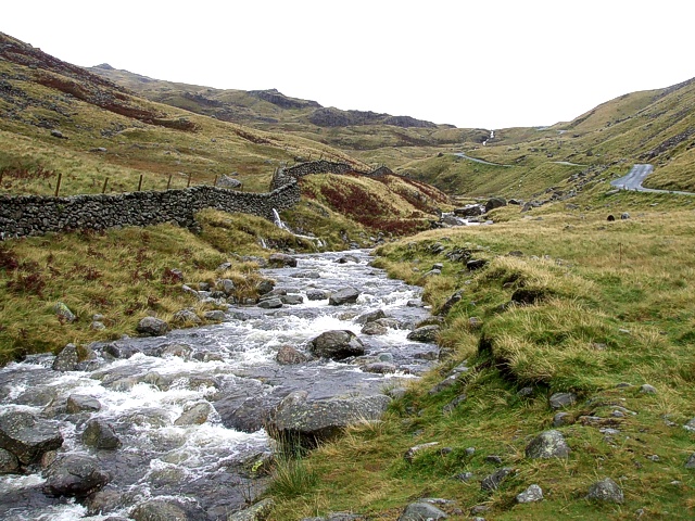
English: River Duddon, Wrynose Pass The River Duddon is seen here flowing alongside the road through Wrynose Pass. This pass is situated between Little Langdale to the east and the Hardknott Pass to the west.
|
| ⧼wm-license-information-date⧽ | 2007 |
| ⧼wm-license-information-source⧽ | From geograph.org.uk |
| ⧼wm-license-information-author⧽ | Rob Farrow |
| ⧼wm-license-cc-attribution⧽ (قالب:I18n/Credit line) |
Rob Farrow / River Duddon, Wrynose Pass / |
54°24′46″N 3°07′34″W / 54.41265°N 3.1261°W قالب:Object location
_heading:67)
ترخيص
تاريخ الملف
اضغط على زمن/تاريخ لرؤية الملف كما بدا في هذا الزمن.
| زمن/تاريخ | صورة مصغرة | الأبعاد | مستخدم | تعليق | |
|---|---|---|---|---|---|
| حالي | ★ مراجعة معتمدة 01:57، 12 نوفمبر 2023 | | 640 × 480 (194 كيلوبايت) | Pastakhov (نقاش | مساهمات) | Upload https://upload.wikimedia.org/wikipedia/commons/2/2d/River_Duddon%2C_Wrynose_Pass_-_geograph.org.uk_-_546589.jpg |
لا يمكنك استبدال هذا الملف.
وصلات
لا يوجد صفحات تصل لهذه الصورة.