ملف:River Carron - geograph.org.uk - 267777.jpg
لا توجد دقة أعلى متوفرة.
River_Carron_-_geograph.org.uk_-_267777.jpg (640 × 480 بكسل حجم الملف: 103 كيلوبايت، نوع MIME: image/jpeg)
وصف قصير
| ⧼wm-license-information-description⧽ |
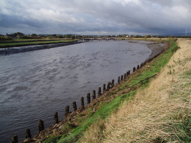
English: River Carron River Carron just east of the M9 not far from where it enters the River Forth.
Only a few miles from the former Carron Ironworks the first major ironworks built in Scotland opened on 1760 closed in 1985 under Thatcher.
|
| ⧼wm-license-information-date⧽ | 2006 |
| ⧼wm-license-information-source⧽ | From geograph.org.uk |
| ⧼wm-license-information-author⧽ | Adam Ward |
| ⧼wm-license-cc-attribution⧽ (قالب:I18n/Credit line) |
Adam Ward / River Carron / |
56°01′21″N 3°44′35″W / 56.0226°N 3.743°W
_heading:270)
ترخيص
تاريخ الملف
اضغط على زمن/تاريخ لرؤية الملف كما بدا في هذا الزمن.
| زمن/تاريخ | صورة مصغرة | الأبعاد | مستخدم | تعليق | |
|---|---|---|---|---|---|
| حالي | ★ مراجعة معتمدة 21:33، 26 أكتوبر 2023 | | 640 × 480 (103 كيلوبايت) | Pastakhov (نقاش | مساهمات) | Upload https://upload.wikimedia.org/wikipedia/commons/c/c6/River_Carron_-_geograph.org.uk_-_267777.jpg |
لا يمكنك استبدال هذا الملف.
وصلات
لا يوجد صفحات تصل لهذه الصورة.