ملف:River-Poddle-2010-02-19a.jpg

الملف الأصلي (1٬000 × 750 بكسل حجم الملف: 244 كيلوبايت، نوع MIME: image/jpeg)
وصف قصير
53°18′20.6604″N 6°19′4.5624″W / 53.305739000°N 6.317934000°W
| ⧼wm-license-information-description⧽ |
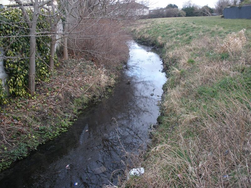
English: View of the River Poddle, Dublin, just a few metres downstream of Templeville Road, the river having crossed under the road behind the camera.
The river is flowing away from the camera, to the northeast. It bends to the left in the foreground and to the right in the background. Houses at the south end of Whitehall Park are visible in the centre background. This location is near the meeting of four townlands. The camera is in Templeogue, divided by the river from Whitehall in the left foreground. Whitehall meets Perrystown only a few metres downstream, on the opposite (north) river bank. Templeogue meets Kimmage on the near (south) river bank, in the far background, where the river has turned right. See also River-Poddle-2010-02-19b.jpg and River-Poddle-2010-02-19c.jpg. |
| ⧼wm-license-information-date⧽ | 2010 |
| ⧼wm-license-information-source⧽ | ⧼Wm-license-own-work⧽ |
| ⧼wm-license-information-author⧽ | User:O'Dea |
| ⧼wm-license-information-other-versions⧽ |
|
ترخيص
|
تاريخ الملف
اضغط على زمن/تاريخ لرؤية الملف كما بدا في هذا الزمن.
| زمن/تاريخ | صورة مصغرة | الأبعاد | مستخدم | تعليق | |
|---|---|---|---|---|---|
| حالي | ★ مراجعة معتمدة 12:34، 21 أكتوبر 2023 | | 1٬000 × 750 (244 كيلوبايت) | Pastakhov (نقاش | مساهمات) | Upload https://upload.wikimedia.org/wikipedia/commons/b/b5/River-Poddle-2010-02-19a.jpg |
لا يمكنك استبدال هذا الملف.
وصلات
لا يوجد صفحات تصل لهذه الصورة.