ملف:Reka-Timavo karta.jpg
حجم هذه المعاينة: 800 × 568 بكسل. البعد الآخر: 1٬106 × 785 بكسل.
الملف الأصلي (1٬106 × 785 بكسل حجم الملف: 102 كيلوبايت، نوع MIME: image/jpeg)
وصف قصير
| ⧼wm-license-information-description⧽ |
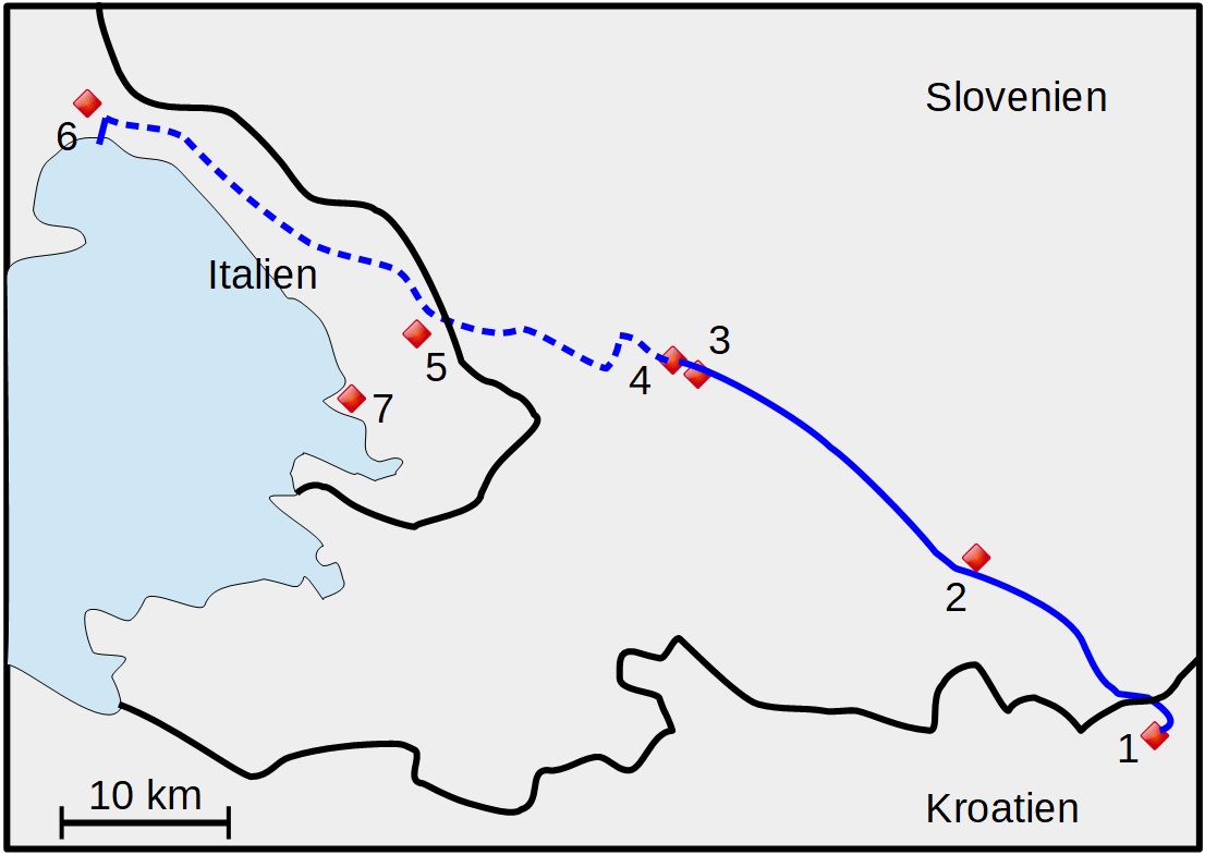
Svenska: Ungefärlig karta över Reka-Timavo. Streckad linje visar flodens underjordiska sträckning (efter Alexander, Paul B.: The Reka-Timavo River System of the Yugoslavian and Italian Karst. Yearbook of the Association of Pacific Coast Geographers Vol. 32 (1970), p. 159).
1=Vela Voda (flod). 2=Ilirska Bistrica. 3=Vremski Britof. 4=Škocjan. 5=Trebiciano. 6=Monfalcone. 7=Trieste
|
| ⧼wm-license-information-date⧽ | 2019 |
| ⧼wm-license-information-source⧽ | ⧼Wm-license-own-work⧽ |
| ⧼wm-license-information-author⧽ | Leksunim |
ترخيص
|
تاريخ الملف
اضغط على زمن/تاريخ لرؤية الملف كما بدا في هذا الزمن.
| زمن/تاريخ | صورة مصغرة | الأبعاد | مستخدم | تعليق | |
|---|---|---|---|---|---|
| حالي | ★ مراجعة معتمدة 22:30، 22 نوفمبر 2023 | | 1٬106 × 785 (102 كيلوبايت) | Pastakhov (نقاش | مساهمات) | Upload https://upload.wikimedia.org/wikipedia/commons/1/19/Reka-Timavo_karta.jpg |
لا يمكنك استبدال هذا الملف.
وصلات
لا يوجد صفحات تصل لهذه الصورة.