ملف:Red Shirt Table.jpg
حجم هذه المعاينة: 189 × 597 بكسل. البعد الآخر: 1٬564 × 4٬941 بكسل.
الملف الأصلي (1٬564 × 4٬941 بكسل حجم الملف: 2٫14 ميجابايت، نوع MIME: image/jpeg)
وصف قصير
| ⧼wm-license-information-description⧽ |
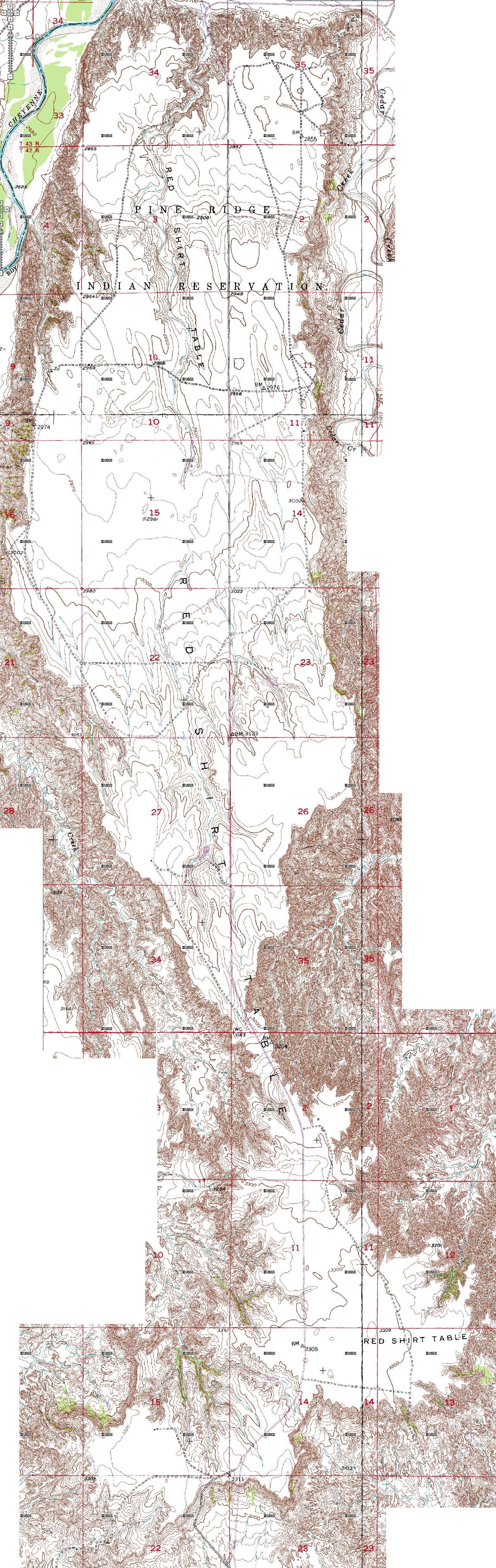
English: Topographic outline of Red Shirt Table, in the Badlands of South Dakota
|
| ⧼wm-license-information-date⧽ | |
| ⧼wm-license-information-source⧽ | USGS topo maps |
| ⧼wm-license-information-author⧽ | U.S. Geological Survey |
ترخيص
This image is a work of a United States Geological Survey employee, taken or made during the course of the person's official duties. As a work of the United States Government, the image is in the public domain. For more information, see the USGS copyright policy.
قالب:Original upload log
| زمن/تاريخ | الأبعاد | مستخدم | تعليق |
|---|---|---|---|
| 2008-03-07 02:59 | 1564×4941× (2241088 bytes) | ArcticBartek | {{Information |Description=topographic outline of Red Shirt Table, in the [[Badlands]] of South Dakota |Source=USGS topo maps |Date= |Location= |Author= |Permission= |other_versions= }} |
تاريخ الملف
اضغط على زمن/تاريخ لرؤية الملف كما بدا في هذا الزمن.
| زمن/تاريخ | صورة مصغرة | الأبعاد | مستخدم | تعليق | |
|---|---|---|---|---|---|
| حالي | ★ مراجعة معتمدة 18:12، 19 يناير 2024 | 1٬564 × 4٬941 (2٫14 ميجابايت) | Pastakhov (نقاش | مساهمات) | Upload https://upload.wikimedia.org/wikipedia/commons/1/18/Red_Shirt_Table.jpg |
لا يمكنك استبدال هذا الملف.
وصلات
لا يوجد صفحات تصل لهذه الصورة.