ملف:Ravensthorpe Gyratory - geograph.org.uk - 78213.jpg
لا توجد دقة أعلى متوفرة.
Ravensthorpe_Gyratory_-_geograph.org.uk_-_78213.jpg (640 × 480 بكسل حجم الملف: 86 كيلوبايت، نوع MIME: image/jpeg)
وصف قصير
| ⧼wm-license-information-description⧽ |
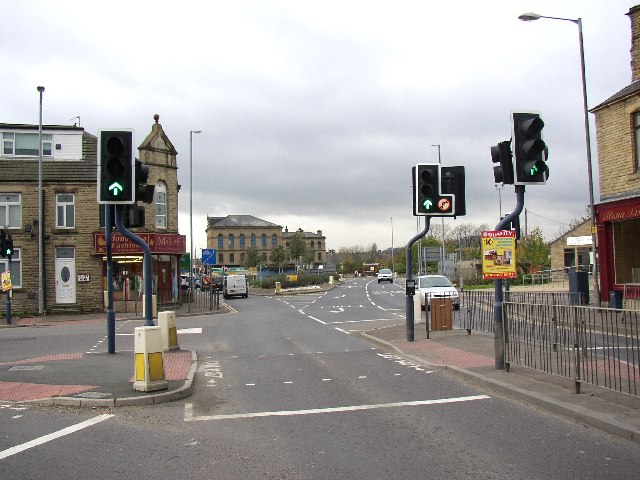
English: Ravensthorpe Gyratory. The A644 through Ravensthorpe is notorious for its rush-hour traffic jams. It is a trunk road shoe-horned into a Victorian street. The traffic lights at the staggered crossroads in the centre of the town were the major cause of congestion, and this has been eased a little by the demolition of building on the north side and the construction of a bone-shaped traffic island. The building on the corner with the free-standing pediment has inscribed on the latter '1905 / Central Buildings'. Ravensthorpe looks like a Danish name, but is a Victorian invention as the town did not exist until the second half of the 19C (it was mostly fields in part of Mirfield). It then grew rapidly and became an Urban District Council in 1894, but was swallowed up by Dewsbury in 1910.
|
| ⧼wm-license-information-date⧽ | 2005 |
| ⧼wm-license-information-source⧽ | From geograph.org.uk |
| ⧼wm-license-information-author⧽ | Humphrey Bolton |
| ⧼wm-license-cc-attribution⧽ (قالب:I18n/Credit line) |
Humphrey Bolton / Ravensthorpe Gyratory / |
ترخيص
تاريخ الملف
اضغط على زمن/تاريخ لرؤية الملف كما بدا في هذا الزمن.
| زمن/تاريخ | صورة مصغرة | الأبعاد | مستخدم | تعليق | |
|---|---|---|---|---|---|
| حالي | ★ مراجعة معتمدة 15:58، 25 يناير 2024 | | 640 × 480 (86 كيلوبايت) | Pastakhov (نقاش | مساهمات) | Upload https://upload.wikimedia.org/wikipedia/commons/f/f3/Ravensthorpe_Gyratory_-_geograph.org.uk_-_78213.jpg |
لا يمكنك استبدال هذا الملف.
وصلات
لا يوجد صفحات تصل لهذه الصورة.