ملف:Prov-Groningen-OpenTopo.jpg
حجم هذه المعاينة: 535 × 599 بكسل. البعد الآخر: 1٬747 × 1٬956 بكسل.
الملف الأصلي (1٬747 × 1٬956 بكسل حجم الملف: 480 كيلوبايت، نوع MIME: image/jpeg)
وصف قصير
| ⧼wm-license-information-description⧽ |
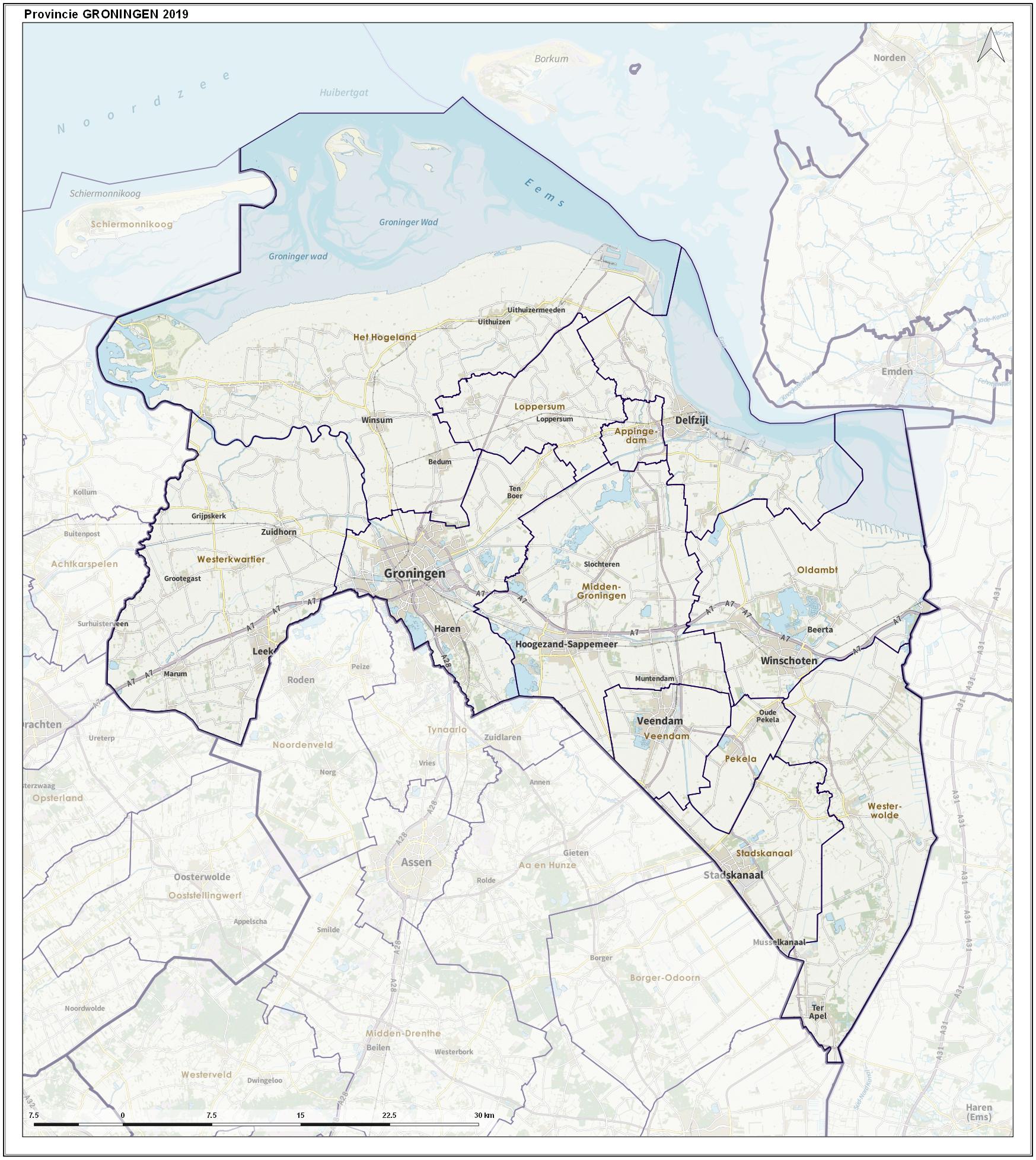
(Dutch) English: Overview map of the province, including municipal borders, largest places and major infrastructure.
|
| ⧼wm-license-information-date⧽ | 2019 |
| ⧼wm-license-information-source⧽ | ⧼Wm-license-own-work⧽ |
| ⧼wm-license-information-author⧽ | Janwillemvanaalst |
ترخيص
|
تاريخ الملف
اضغط على زمن/تاريخ لرؤية الملف كما بدا في هذا الزمن.
| زمن/تاريخ | صورة مصغرة | الأبعاد | مستخدم | تعليق | |
|---|---|---|---|---|---|
| حالي | ★ مراجعة معتمدة 05:22، 14 يناير 2024 | | 1٬747 × 1٬956 (480 كيلوبايت) | Pastakhov (نقاش | مساهمات) | Upload https://upload.wikimedia.org/wikipedia/commons/6/6d/Prov-Groningen-OpenTopo.jpg |
لا يمكنك استبدال هذا الملف.
وصلات
لا يوجد صفحات تصل لهذه الصورة.