ملف:Praying Mantis operation map-fr.svg

حجم معاينة PNG لذلك الملف ذي الامتداد SVG: 755 × 598 بكسل. البعد الآخر: 2٬560 × 2٬028 بكسل.
الملف الأصلي (ملف SVG، أبعاده 755 × 598 بكسل، حجم الملف: 1٫04 ميجابايت)
| ⧼wm-license-information-description⧽ |
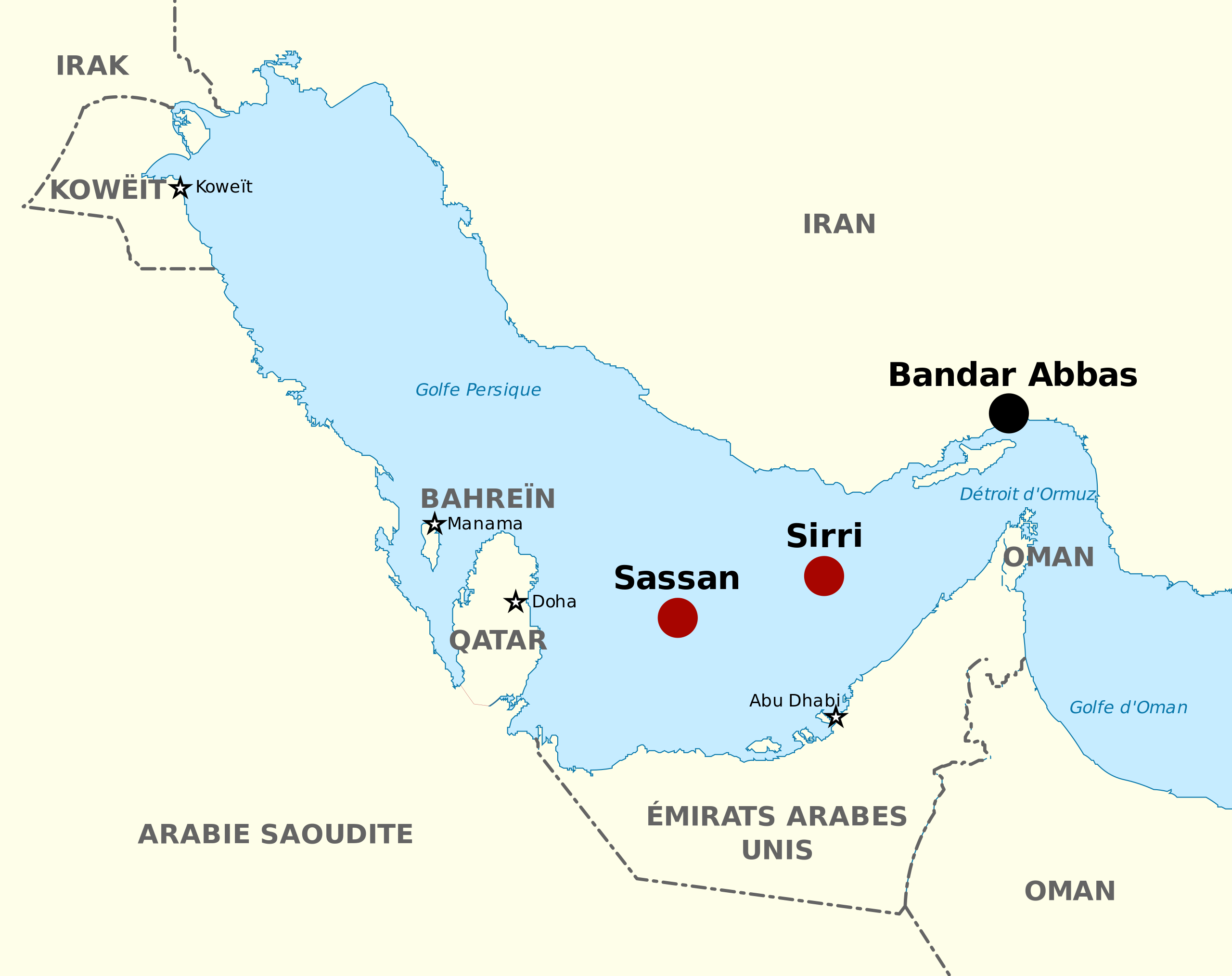
English: Map of the Praying Mantis operation showing the location of the city of Bandar Abbas and Sassan and Sirri, two iranian oilrigs which were destroyed while Operation Praying Mantis on April 18, 1988 Français : Carte de la bataille des plates-formes pétrolières Sassan et Sirri. On peut y voir la cité de Bandar Abbas et la position des deux plates-formes pétrolières iraniennes qui furent détruites pendant l'opération Praying Mantis le 18 avril 1988
|
||
| ⧼wm-license-information-date⧽ | 2009 | ||
| ⧼wm-license-information-source⧽ |
|
||
| ⧼wm-license-information-author⧽ | Pethrus |
|

.svg&action=edit&redlink=1)
تاريخ الملف
اضغط على زمن/تاريخ لرؤية الملف كما بدا في هذا الزمن.
| زمن/تاريخ | صورة مصغرة | الأبعاد | مستخدم | تعليق | |
|---|---|---|---|---|---|
| حالي | ★ مراجعة معتمدة 06:31، 5 ديسمبر 2023 | | 755 × 598 (1٫04 ميجابايت) | Pastakhov (نقاش | مساهمات) | Upload https://upload.wikimedia.org/wikipedia/commons/b/b8/Praying_Mantis_operation_map-fr.svg |
لا يمكنك استبدال هذا الملف.
وصلات
لا يوجد صفحات تصل لهذه الصورة.