ملف:Potohar Plateau Location Map.svg

حجم معاينة PNG لذلك الملف ذي الامتداد SVG: 750 × 599 بكسل. البعد الآخر: 2٬560 × 2٬046 بكسل.
الملف الأصلي (ملف SVG، أبعاده 2٬365 × 1٬890 بكسل، حجم الملف: 786 كيلوبايت)
وصف قصير
| ⧼wm-license-information-description⧽ |
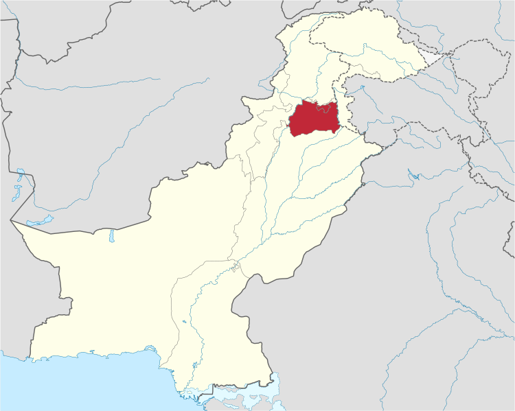
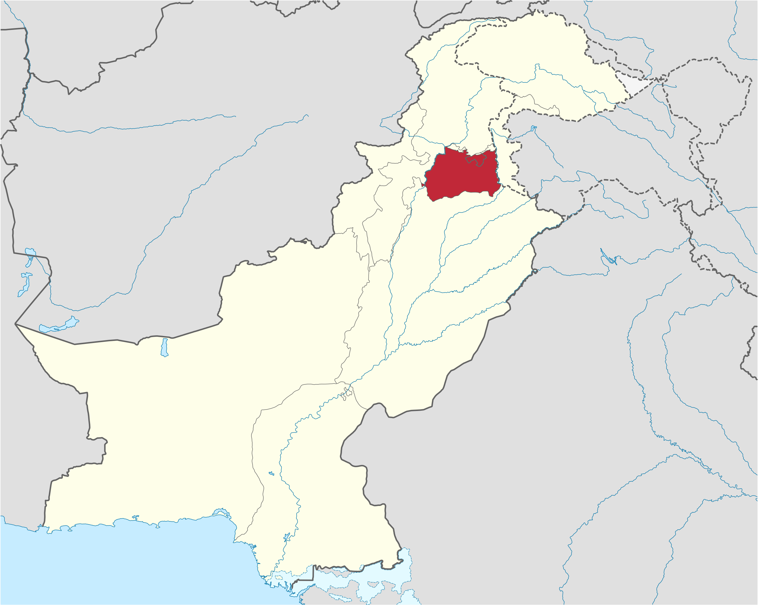
English: A map highlighting the region of the Potohar plateau in Pakistan.
|
| ⧼wm-license-information-date⧽ | 2008 |
| ⧼wm-license-information-source⧽ | File:Pakistan_location_map.svg |
| ⧼wm-license-information-author⧽ | Elraja1988 |
ترخيص
|
|
هذا الملفُّ مُرخَّص بموجب رخصة المشاع الإبداعي نسبة المُصنَّف إِلى مؤلفه - المشاركة بالمثل 3.0 العامة. |

|
قالب:Original upload log
قالب:Original description page
- 2012-03-02 19:15 Elraja1988 2365×1890× (804699 bytes) More accurate mapping, previous map was locations of constituent districts, this map is a better representation of where exactly the plateau lies within the greater pothohar region.
- 2012-03-02 11:16 Elraja1988 2365×1890× (807449 bytes) Uploading a file from a free published source using [[Wikipedia:File_Upload_Wizard|File Upload Wizard]]
تاريخ الملف
اضغط على زمن/تاريخ لرؤية الملف كما بدا في هذا الزمن.
| زمن/تاريخ | صورة مصغرة | الأبعاد | مستخدم | تعليق | |
|---|---|---|---|---|---|
| حالي | ★ مراجعة معتمدة 00:50، 16 نوفمبر 2023 | | 2٬365 × 1٬890 (786 كيلوبايت) | Pastakhov (نقاش | مساهمات) | Upload https://upload.wikimedia.org/wikipedia/commons/2/2f/Potohar_Plateau_Location_Map.svg |
لا يمكنك استبدال هذا الملف.
وصلات
لا يوجد صفحات تصل لهذه الصورة.