ملف:Plymouth from Mount Batten - geograph.org.uk - 1580485.jpg
لا توجد دقة أعلى متوفرة.
Plymouth_from_Mount_Batten_-_geograph.org.uk_-_1580485.jpg (640 × 364 بكسل حجم الملف: 49 كيلوبايت، نوع MIME: image/jpeg)
وصف قصير
| ⧼wm-license-information-description⧽ |
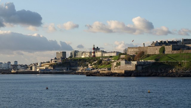
English: Plymouth from Mount Batten. Looking across the northeast corner of Plymouth Sound. By the water right of centre is the Royal Plymouth Corinthian Yacht Club, below Madeira Road and The Citadel https://www.geograph.org.uk/gridref/SX4853?centi=SX481537 . Smeaton Tower and The Hoe are in SX4753.
See 1214533 for a closer zoom on the centre of this scene.
|
| ⧼wm-license-information-date⧽ | 2009 |
| ⧼wm-license-information-source⧽ | From geograph.org.uk |
| ⧼wm-license-information-author⧽ | Derek Harper |
| ⧼wm-license-cc-attribution⧽ (قالب:I18n/Credit line) |
Derek Harper / Plymouth from Mount Batten / |
50°21′38″N 4°07′48″W / 50.36057°N 4.1301°W قالب:Object location
_heading:292)
ترخيص
تاريخ الملف
اضغط على زمن/تاريخ لرؤية الملف كما بدا في هذا الزمن.
| زمن/تاريخ | صورة مصغرة | الأبعاد | مستخدم | تعليق | |
|---|---|---|---|---|---|
| حالي | ★ مراجعة معتمدة 06:15، 11 أكتوبر 2023 | | 640 × 364 (49 كيلوبايت) | Pastakhov (نقاش | مساهمات) | Upload https://upload.wikimedia.org/wikipedia/commons/7/77/Plymouth_from_Mount_Batten_-_geograph.org.uk_-_1580485.jpg |
لا يمكنك استبدال هذا الملف.
وصلات
لا يوجد صفحات تصل لهذه الصورة.