ملف:Pike County Illinois Incorporated and Unincorporated areas New Salem Highlighted.svg

حجم معاينة PNG لذلك الملف ذي الامتداد SVG: 502 × 271 بكسل. البعد الآخر: 2٬560 × 1٬382 بكسل.
الملف الأصلي (ملف SVG، أبعاده 502 × 271 بكسل، حجم الملف: 404 كيلوبايت)
وصف قصير
| ⧼wm-license-information-description⧽ |
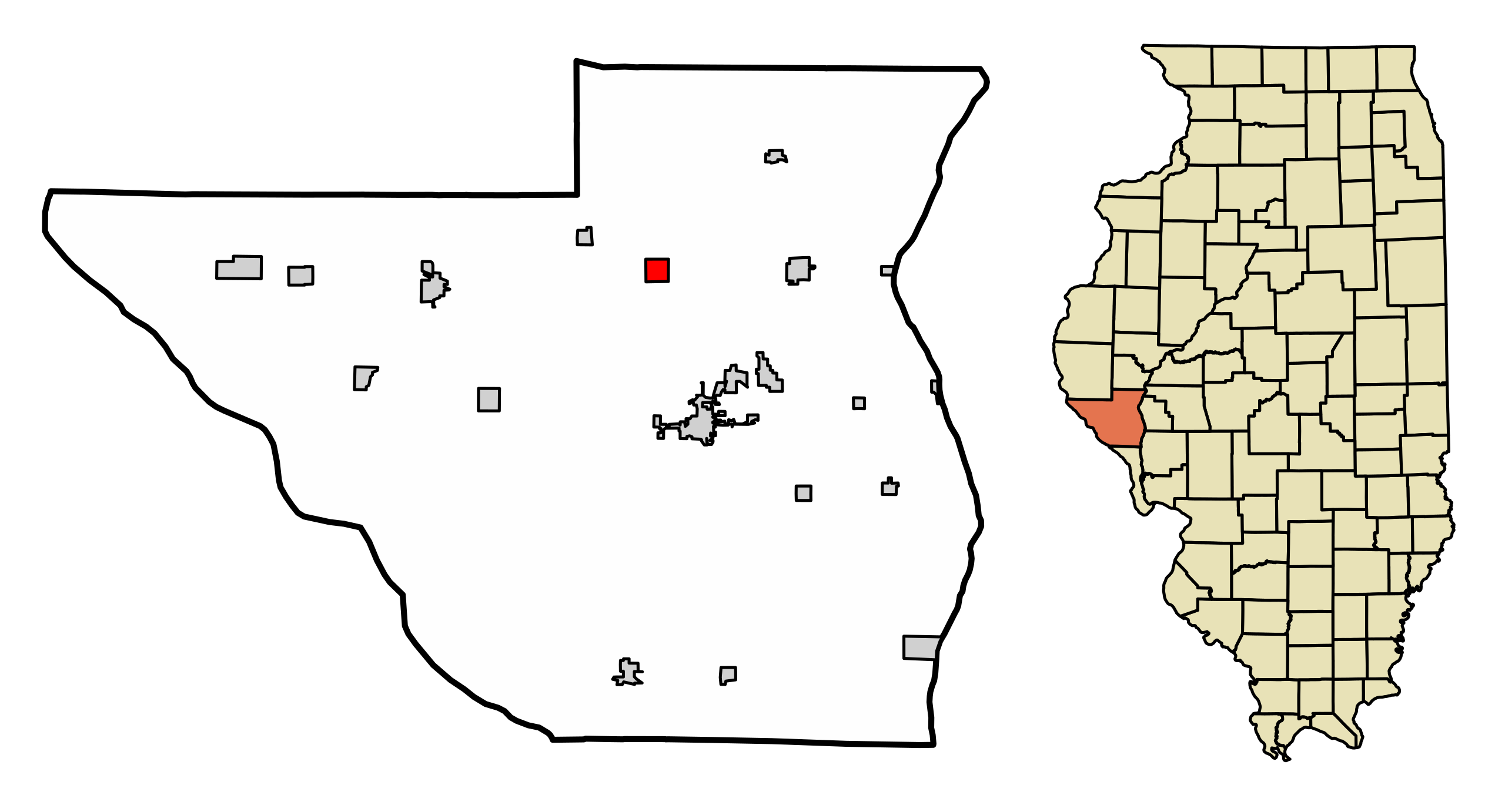
My own work, based on public domain information. Based on similar map concepts by w:User:Arkyan This map shows the incorporated and unincorporated areas in Pike County, Illinois, highlighting New Salem in red. It was created from US Census Bureau data with the help of a custom fork of the kartography project, available on Github at |
| ⧼wm-license-information-date⧽ | |
| ⧼wm-license-information-source⧽ | قالب:Own work by original uploader |
| ⧼wm-license-information-author⧽ | DemocraticLuntz |
ترخيص
www
قالب:Original upload log
| زمن/تاريخ | الأبعاد | مستخدم | تعليق |
|---|---|---|---|
| 2017-07-12 17:29:57 | 502 × 271 | DemocraticLuntz | |
| 2017-07-11 19:59:46 | 502 × 271 | DemocraticLuntz | |
| 2017-06-28 20:39:44 | 502 × 313 | DemocraticLuntz | My own work, based on public domain information. Based on similar map concepts by [[User:Arkyan]] This map shows the incorporated and unincorporated areas in Pike County, Illinois, highlighting New Salem in red. It was created from US Census Bureau da... |
تاريخ الملف
اضغط على زمن/تاريخ لرؤية الملف كما بدا في هذا الزمن.
| زمن/تاريخ | صورة مصغرة | الأبعاد | مستخدم | تعليق | |
|---|---|---|---|---|---|
| حالي | ★ مراجعة معتمدة 16:10، 20 أكتوبر 2023 | | 502 × 271 (404 كيلوبايت) | Pastakhov (نقاش | مساهمات) | Upload https://upload.wikimedia.org/wikipedia/commons/6/69/Pike_County_Illinois_Incorporated_and_Unincorporated_areas_New_Salem_Highlighted.svg |
لا يمكنك استبدال هذا الملف.
وصلات
لا يوجد صفحات تصل لهذه الصورة.