ملف:Pentrefoelas, The Foelas Arms - geograph.org.uk - 55301.jpg
لا توجد دقة أعلى متوفرة.
Pentrefoelas,_The_Foelas_Arms_-_geograph.org.uk_-_55301.jpg (640 × 427 بكسل حجم الملف: 123 كيلوبايت، نوع MIME: image/jpeg)
وصف قصير
| ⧼wm-license-information-description⧽ |
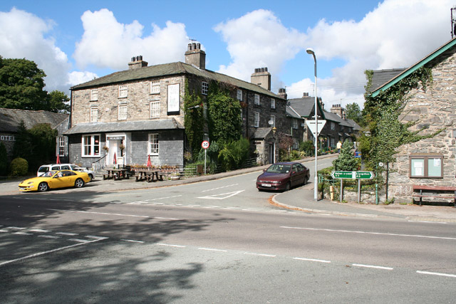
English: Pentrefoelas: The Foelas Arms. An hotel on the A5 road, the trunk route surveyed by Telford in 1815-1817, linking London and Holyhead and facilitating improved communications with Dublin
|
| ⧼wm-license-information-date⧽ | 2005 |
| ⧼wm-license-information-source⧽ | From geograph.org.uk |
| ⧼wm-license-information-author⧽ | Martin Bodman |
| ⧼wm-license-cc-attribution⧽ (قالب:I18n/Credit line) |
Martin Bodman / Pentrefoelas: The Foelas Arms / |
53°02′54″N 3°40′55″W / 53.0484°N 3.682°W قالب:Object location
)
ترخيص
تاريخ الملف
اضغط على زمن/تاريخ لرؤية الملف كما بدا في هذا الزمن.
| زمن/تاريخ | صورة مصغرة | الأبعاد | مستخدم | تعليق | |
|---|---|---|---|---|---|
| حالي | ★ مراجعة معتمدة 17:08، 27 أكتوبر 2023 | | 640 × 427 (123 كيلوبايت) | Pastakhov (نقاش | مساهمات) | Upload https://upload.wikimedia.org/wikipedia/commons/f/f3/Pentrefoelas%2C_The_Foelas_Arms_-_geograph.org.uk_-_55301.jpg |
لا يمكنك استبدال هذا الملف.
وصلات
لا يوجد صفحات تصل لهذه الصورة.