ملف:Pennsylvania Avenue Historic Site boundaries.jpg
حجم هذه المعاينة: 800 × 473 بكسل. البعد الآخر: 914 × 540 بكسل.
الملف الأصلي (914 × 540 بكسل حجم الملف: 270 كيلوبايت، نوع MIME: image/jpeg)
وصف قصير
| ⧼wm-license-information-description⧽ |
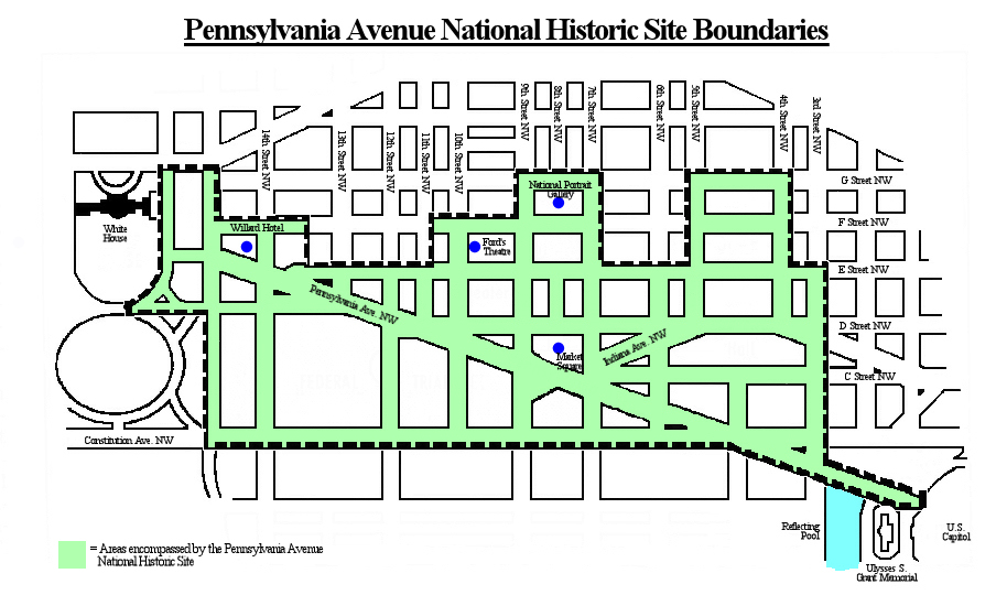
English: Map of downtown Washington, D.C., in the United States, showing the boundaries (in green) of the Pennsylvania Avenue National Historic Site. Boundaries per Eisen, Jack. "Avenue Given Historic Site Designation." Washington Post. October 1, 1965.
|
| ⧼wm-license-information-date⧽ | 2010 |
| ⧼wm-license-information-source⧽ | ⧼Wm-license-own-work⧽ |
| ⧼wm-license-information-author⧽ | Tim1965 |
ترخيص
|

تاريخ الملف
اضغط على زمن/تاريخ لرؤية الملف كما بدا في هذا الزمن.
| زمن/تاريخ | صورة مصغرة | الأبعاد | مستخدم | تعليق | |
|---|---|---|---|---|---|
| حالي | ★ مراجعة معتمدة 12:40، 3 نوفمبر 2023 | | 914 × 540 (270 كيلوبايت) | Pastakhov (نقاش | مساهمات) | Upload https://upload.wikimedia.org/wikipedia/commons/2/22/Pennsylvania_Avenue_Historic_Site_boundaries.jpg |
لا يمكنك استبدال هذا الملف.
وصلات
لا يوجد صفحات تصل لهذه الصورة.