ملف:Peakshole Sough (geograph 3229753).jpg

حجم هذه المعاينة: 397 × 599 بكسل. البعد الآخر: 424 × 640 بكسل.
الملف الأصلي (424 × 640 بكسل حجم الملف: 291 كيلوبايت، نوع MIME: image/jpeg)
وصف قصير
| ⧼wm-license-information-description⧽ |
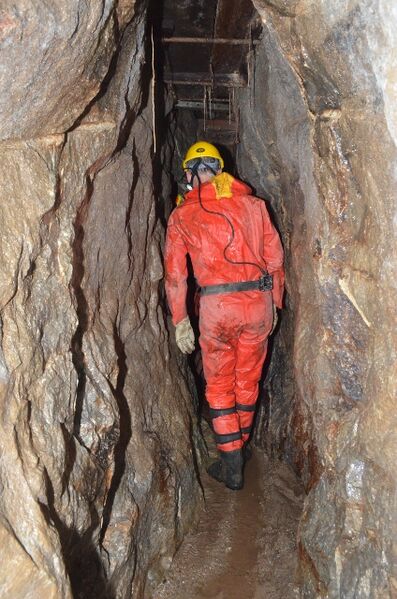
English: Peakshole Sough. A view of the sough (and vein) which was constructed to drain Wall End mine in the late 1700s. An inscription reads WW 1774. The sough is still in water but then dries out further in before a junction is met; one follows a small vein (Peakshole Vein) and the other passage ceases. Ladders lead up to the mine via tight stopes. The top reveals a small junction and very tight passages revealing the shafts to the surface. Mineralisation is in the form of a ENE-WSW vein and two cavity-filling pipes. This vein runs along a Namurian (mid-Carboniferous) wrench fault caused by rotation of the stress field at the time, the result of uplift of the North Derbyshire shelf. The mine contains F-Ca-Ba-Pb mineralisation.
|
| ⧼wm-license-information-date⧽ | 2012 |
| ⧼wm-license-information-source⧽ | From geograph.org.uk |
| ⧼wm-license-information-author⧽ | Ashley Dace |
| ⧼wm-license-information-permission⧽ (⧼wm-license-information-permission-reusing-text⧽) |
Creative Commons Attribution Share-alike license 2.0 |
| ⧼wm-license-cc-attribution⧽ (قالب:I18n/Credit line) |
Ashley Dace / Peakshole Sough / |
53°20′28″N 1°46′46″W / 53.340997°N 1.779482°W قالب:Object location
.jpg¶ms=53.340997_N_1.779482_W_source:geograph-osgb36(SK14788270)_heading:247)
ترخيص
تاريخ الملف
اضغط على زمن/تاريخ لرؤية الملف كما بدا في هذا الزمن.
| زمن/تاريخ | صورة مصغرة | الأبعاد | مستخدم | تعليق | |
|---|---|---|---|---|---|
| حالي | ★ مراجعة معتمدة 08:38، 23 نوفمبر 2023 | | 424 × 640 (291 كيلوبايت) | Pastakhov (نقاش | مساهمات) | Upload https://upload.wikimedia.org/wikipedia/commons/c/ca/Peakshole_Sough_%28geograph_3229753%29.jpg |
لا يمكنك استبدال هذا الملف.
وصلات
لا يوجد صفحات تصل لهذه الصورة.
.jpg&oldid=3574506)