ملف:Parthian Empire at its greatest extent.png
حجم هذه المعاينة: 612 × 600 بكسل. البعد الآخر: 813 × 797 بكسل.
الملف الأصلي (813 × 797 بكسل حجم الملف: 26 كيلوبايت، نوع MIME: image/png)
وصف قصير
قالب:Uploaded with en.wp UW marker
| ⧼wm-license-information-description⧽ |
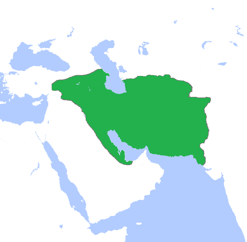
English: This map depicts the Parthian Empire at its greatest territorial extent.
|
| ⧼wm-license-information-date⧽ | 2013 |
| ⧼wm-license-information-source⧽ | I drew the borders and colored the map. |
| ⧼wm-license-information-author⧽ | Keeby101 |
| ⧼wm-license-information-other-versions⧽ |
ترخيص
|

.jpg)
تاريخ الملف
اضغط على زمن/تاريخ لرؤية الملف كما بدا في هذا الزمن.
| زمن/تاريخ | صورة مصغرة | الأبعاد | مستخدم | تعليق | |
|---|---|---|---|---|---|
| حالي | ★ مراجعة معتمدة 22:20، 19 أكتوبر 2023 | | 813 × 797 (26 كيلوبايت) | Pastakhov (نقاش | مساهمات) | Upload https://upload.wikimedia.org/wikipedia/commons/a/ae/Parthian_Empire_at_its_greatest_extent.png |
لا يمكنك استبدال هذا الملف.
وصلات
لا يوجد صفحات تصل لهذه الصورة.