ملف:Paris - La Chapelle - Plan 18e arrondissement (4).svg

حجم معاينة PNG لذلك الملف ذي الامتداد SVG: 336 × 599 بكسل. البعد الآخر: 1٬149 × 2٬048 بكسل.
الملف الأصلي (ملف SVG، أبعاده 1٬081 × 1٬926 بكسل، حجم الملف: 6٫04 ميجابايت)
وصف قصير
| ⧼wm-license-information-description⧽ |
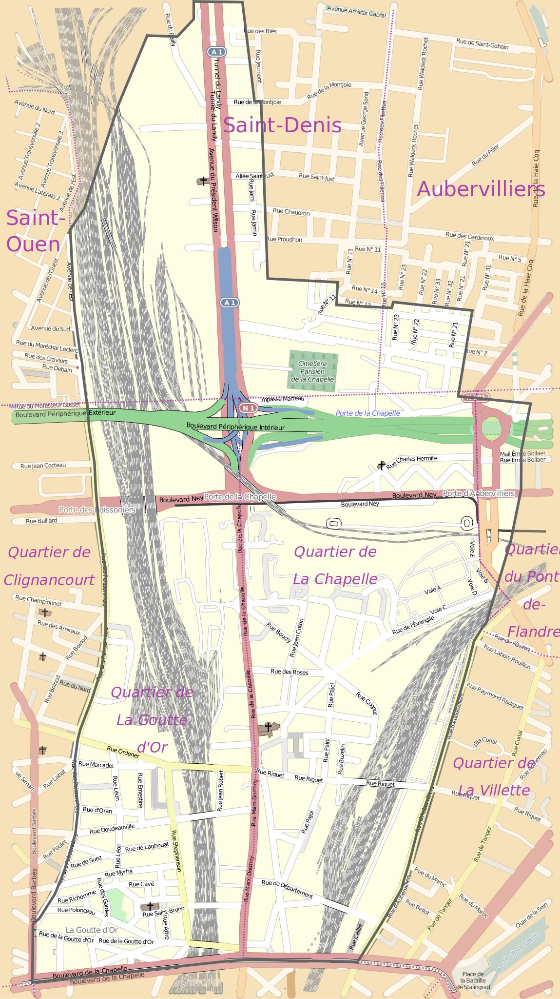
Français : Plan de l'ancienne commune de La Chapelle rapportée au plan de 2015.
|
| ⧼wm-license-information-date⧽ | 2015 |
| ⧼wm-license-information-source⧽ | ⧼Wm-license-own-work⧽ à partir du plan actuel d'OpenStreeMap retravaillé et des données cadastrales de la commune de La Chapelle aux archives de Paris |
| ⧼wm-license-information-author⧽ | Starus |
ترخيص
|
تاريخ الملف
اضغط على زمن/تاريخ لرؤية الملف كما بدا في هذا الزمن.
| زمن/تاريخ | صورة مصغرة | الأبعاد | مستخدم | تعليق | |
|---|---|---|---|---|---|
| حالي | ★ مراجعة معتمدة 13:53، 13 أكتوبر 2023 | | 1٬081 × 1٬926 (6٫04 ميجابايت) | Pastakhov (نقاش | مساهمات) | Upload https://upload.wikimedia.org/wikipedia/commons/3/3b/Paris_-_La_Chapelle_-_Plan_18e_arrondissement_%284%29.svg |
لا يمكنك استبدال هذا الملف.
وصلات
لا يوجد صفحات تصل لهذه الصورة.
.svg&oldid=3097436)