ملف:Outline Map of Sevastopol.svg

حجم معاينة PNG لذلك الملف ذي الامتداد SVG: 325 × 395 بكسل. البعد الآخر: 1٬685 × 2٬048 بكسل.
الملف الأصلي (ملف SVG، أبعاده 325 × 395 بكسل، حجم الملف: 95 كيلوبايت)
وصف قصير
| ⧼wm-license-information-description⧽ |
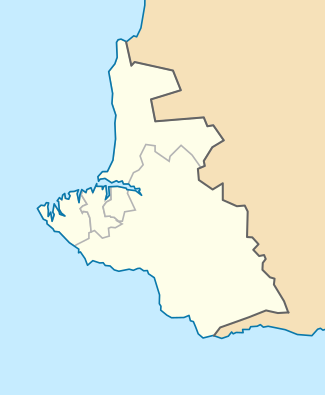
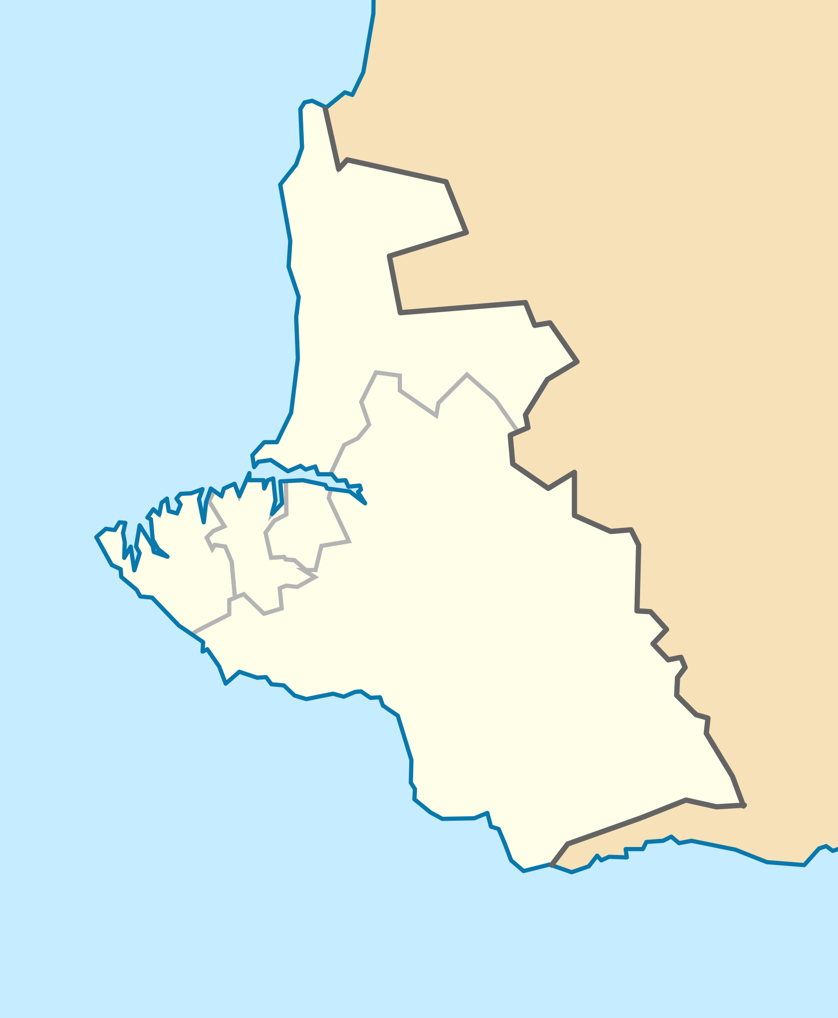
English: equirectangular Map of Sevastopol (as requested on https://en.wikipedia.org/wiki/Wikipedia:Graphics_Lab/Map_workshop#Equirectangular_projection_of_Sevastopol ) showing the districts of Sevastopol: Gagarin Raion, Lenin Raion, Nakhimov Raion, and Balaklava Raion.
Template parameters (coordinates of the edges):
|
| ⧼wm-license-information-date⧽ | 2014, {{time}} – invalid date format 41 (help) |
| ⧼wm-license-information-source⧽ | ⧼Wm-license-own-work⧽ |
| ⧼wm-license-information-author⧽ | DLommes |
ترخيص
|
تاريخ الملف
اضغط على زمن/تاريخ لرؤية الملف كما بدا في هذا الزمن.
| زمن/تاريخ | صورة مصغرة | الأبعاد | مستخدم | تعليق | |
|---|---|---|---|---|---|
| حالي | ★ مراجعة معتمدة 17:54، 19 أكتوبر 2023 | | 325 × 395 (95 كيلوبايت) | Pastakhov (نقاش | مساهمات) | Upload https://upload.wikimedia.org/wikipedia/commons/7/75/Outline_Map_of_Sevastopol.svg |
لا يمكنك استبدال هذا الملف.
وصلات
الصفحات التالية تحتوي على وصلة لهذه الصورة: