ملف:Omulyakhskaya and Khromskaya Bays, Northern Siberia.jpg

حجم هذه المعاينة: 800 × 533 بكسل. البعدان الآخران: 2٬560 × 1٬707 بكسل | 4٬696 × 3٬131 بكسل.
الملف الأصلي (4٬696 × 3٬131 بكسل حجم الملف: 4٫69 ميجابايت، نوع MIME: image/jpeg)
وصف قصير
| ⧼wm-license-information-description⧽ |
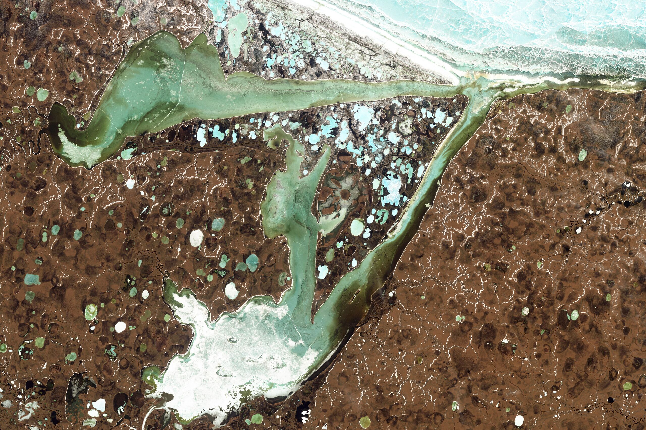
English: Natural-colour image of the Omulyakhskaya and Khromskaya Bays, Russia. The land around the bays is dotted with thermokarst lakes, which result from water released by thawing permafrost. The water in a thermokarst lake doesn’t always stay put; these lakes can melt through the surrounding permafrost and drain into a nearby water body, especially if it sits at a slightly lower elevation. This appears to have occurred in multiple lakes between the bays shown above. (The compound lakes are identifiable by their uneven margins.) Coastal erosion and river migration also can deplete the lakes. Dark brown spots, especially numerous east of Khromskaya Bay, are probably locations of former thermokarst lakes.
Image captured by the Thematic Mapper on the Landsat 5 satellite. Landsat data provided by the United States Geological Survey. |
| ⧼wm-license-information-date⧽ | 2009 |
| ⧼wm-license-information-source⧽ | NASA Earth Observatory |
| ⧼wm-license-information-author⧽ | Jesse Allen and Robert Simmon |
| ⧼wm-license-information-other-versions⧽ |
ترخيص
تاريخ الملف
اضغط على زمن/تاريخ لرؤية الملف كما بدا في هذا الزمن.
| زمن/تاريخ | صورة مصغرة | الأبعاد | مستخدم | تعليق | |
|---|---|---|---|---|---|
| حالي | ★ مراجعة معتمدة 18:57، 8 نوفمبر 2023 | | 4٬696 × 3٬131 (4٫69 ميجابايت) | Pastakhov (نقاش | مساهمات) | Upload https://upload.wikimedia.org/wikipedia/commons/b/b2/Omulyakhskaya_and_Khromskaya_Bays%2C_Northern_Siberia.jpg |
لا يمكنك استبدال هذا الملف.
وصلات
لا يوجد صفحات تصل لهذه الصورة.