ملف:Norwegian Hereditary Empire excluding Greenland.png
حجم هذه المعاينة: 720 × 600 بكسل. البعد الآخر: 1٬200 × 1٬000 بكسل.
الملف الأصلي (1٬200 × 1٬000 بكسل حجم الملف: 31 كيلوبايت، نوع MIME: image/png)
وصف قصير
| ⧼wm-license-information-description⧽ |
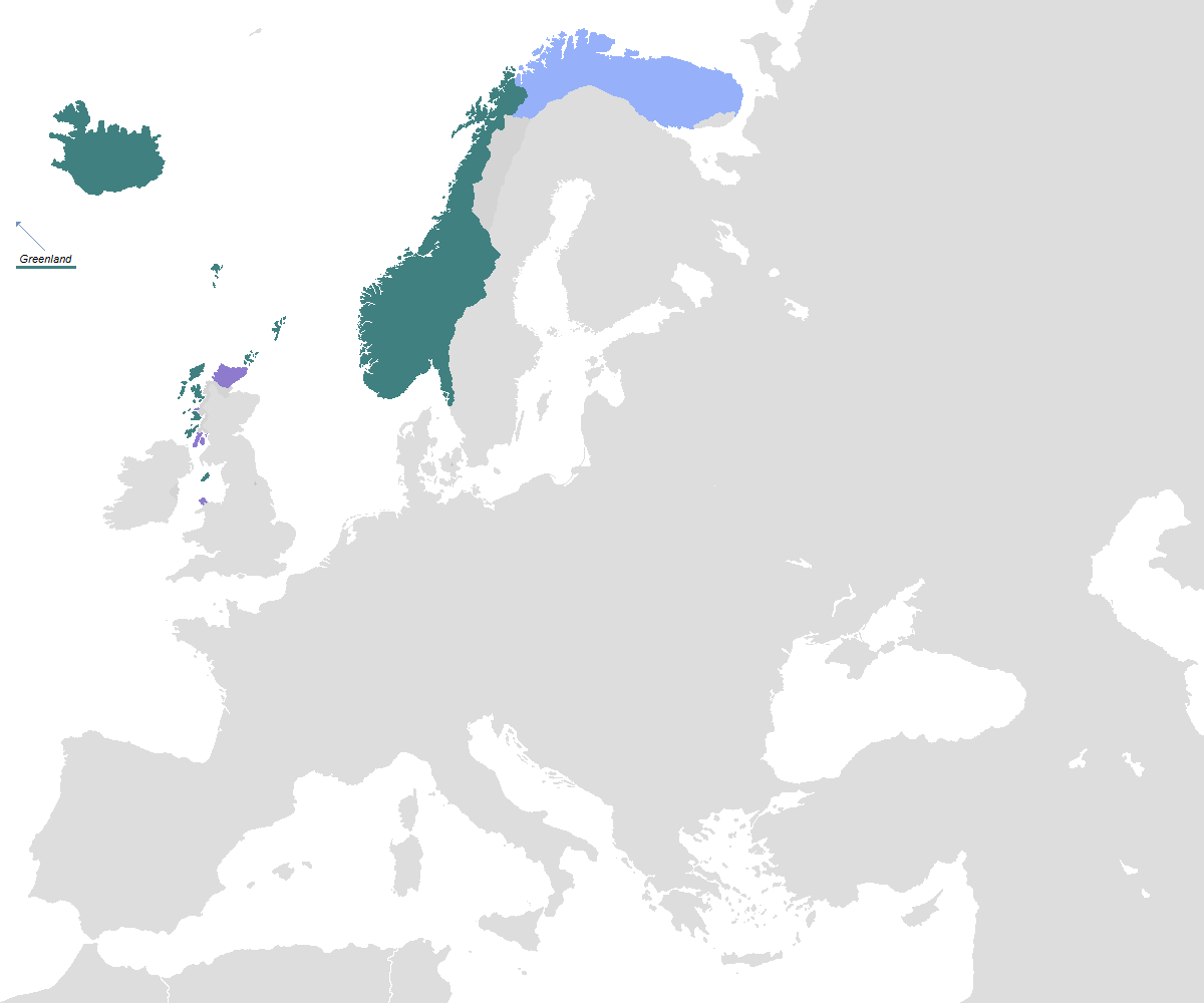
English: Map of the Norwegian Empire at its greatest extent during the period between the 1200s and 1814. Areas under the Crown of Norway. Areas function as Vassals of Norway. Joint tax territory of Norway, Russia and Sweden. Short-ruled areas (uncertain borders) of Norway. Self-made from File:Blank map europe.png, based on File:Norway1265.png and File:Sweden 1250 cropped.png. |
| ⧼wm-license-information-date⧽ | 2016 |
| ⧼wm-license-information-source⧽ | ⧼Wm-license-own-work⧽ |
| ⧼wm-license-information-author⧽ | OnWikiNo |
| ⧼wm-license-information-other-versions⧽ |
|
ترخيص
|
تاريخ الملف
اضغط على زمن/تاريخ لرؤية الملف كما بدا في هذا الزمن.
| زمن/تاريخ | صورة مصغرة | الأبعاد | مستخدم | تعليق | |
|---|---|---|---|---|---|
| حالي | ★ مراجعة معتمدة 18:39، 26 أكتوبر 2023 | | 1٬200 × 1٬000 (31 كيلوبايت) | Pastakhov (نقاش | مساهمات) | Upload https://upload.wikimedia.org/wikipedia/commons/e/ec/Norwegian_Hereditary_Empire_excluding_Greenland.png |
لا يمكنك استبدال هذا الملف.
وصلات
الصفحات التالية تحتوي على وصلة لهذه الصورة: