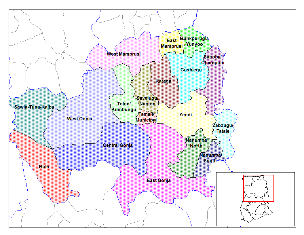
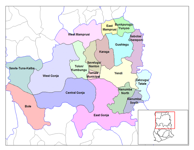
ملف:Northern Ghana districts.png
حجم هذه المعاينة: 776 × 600 بكسل. البعد الآخر: 1٬056 × 816 بكسل.
الملف الأصلي (1٬056 × 816 بكسل حجم الملف: 49 كيلوبايت، نوع MIME: image/png)
وصف قصير
| ⧼wm-license-information-description⧽ |
from en:districts of ghana Map of the districts of the Northern region of Ghana. Created by Rarelibra for public domain use. Created using MapInfo Professional v7.5 and various mapping resources.11 I, the creator of this work, hereby release it into the public domain. This applies worldwide. In case this is not legally possible, I grant any entity the right to use this work for any purpose, without any conditions, unless such conditions are required by law. File history |
| ⧼wm-license-information-date⧽ | قالب:Original upload date |
| ⧼wm-license-information-source⧽ | No machine-readable source provided. Own work assumed (based on copyright claims). |
| ⧼wm-license-information-author⧽ | No machine-readable author provided. Ahanta assumed (based on copyright claims). |
ترخيص
تاريخ الملف
اضغط على زمن/تاريخ لرؤية الملف كما بدا في هذا الزمن.
| زمن/تاريخ | صورة مصغرة | الأبعاد | مستخدم | تعليق | |
|---|---|---|---|---|---|
| حالي | ★ مراجعة معتمدة 01:48، 13 أكتوبر 2023 | | 1٬056 × 816 (49 كيلوبايت) | Pastakhov (نقاش | مساهمات) | Upload https://upload.wikimedia.org/wikipedia/commons/8/8c/Northern_Ghana_districts.png |
لا يمكنك استبدال هذا الملف.
وصلات
لا يوجد صفحات تصل لهذه الصورة.