ملف:North rhine w hsk grey.png
لا توجد دقة أعلى متوفرة.
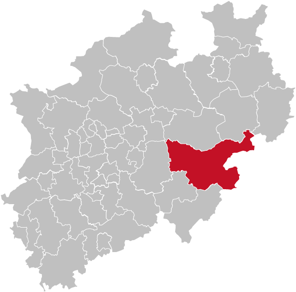
North_rhine_w_hsk_grey.png (593 × 585 بكسل حجم الملف: 71 كيلوبايت، نوع MIME: image/png)
وصف قصير
| ⧼wm-license-information-description⧽ |
Map of Hochsauerlandkreis, a District of Northrhine-Westphalia (NRW), Germany. Red/Grey colors match the color scheme of Germany maps and information boxes in German Wikipedia. Kreis is highlighted in red. Former version of map was based upon [:Image:North rhine w template.png] that displayed some districts in the Cologne/Bonn area not correctly.This new version is based upon template: خطأ: الصورة غير صحيحة أو غير موجودة |
| ⧼wm-license-information-date⧽ | 2008 |
| ⧼wm-license-information-source⧽ | self-made, based upon GeoServer NRW |
| ⧼wm-license-information-author⧽ | TUBS |
ترخيص
|

تاريخ الملف
اضغط على زمن/تاريخ لرؤية الملف كما بدا في هذا الزمن.
| زمن/تاريخ | صورة مصغرة | الأبعاد | مستخدم | تعليق | |
|---|---|---|---|---|---|
| حالي | ★ مراجعة معتمدة 11:12، 15 يناير 2024 | | 593 × 585 (71 كيلوبايت) | Pastakhov (نقاش | مساهمات) | Upload https://upload.wikimedia.org/wikipedia/commons/b/be/North_rhine_w_hsk_grey.png |
لا يمكنك استبدال هذا الملف.
وصلات
لا يوجد صفحات تصل لهذه الصورة.