ملف:North Shore MA.png
حجم هذه المعاينة: 800 × 500 بكسل. البعد الآخر: 1٬600 × 1٬000 بكسل.
الملف الأصلي (1٬600 × 1٬000 بكسل حجم الملف: 403 كيلوبايت، نوع MIME: image/png)
وصف قصير
قالب:Igen
| ⧼wm-license-information-description⧽ |
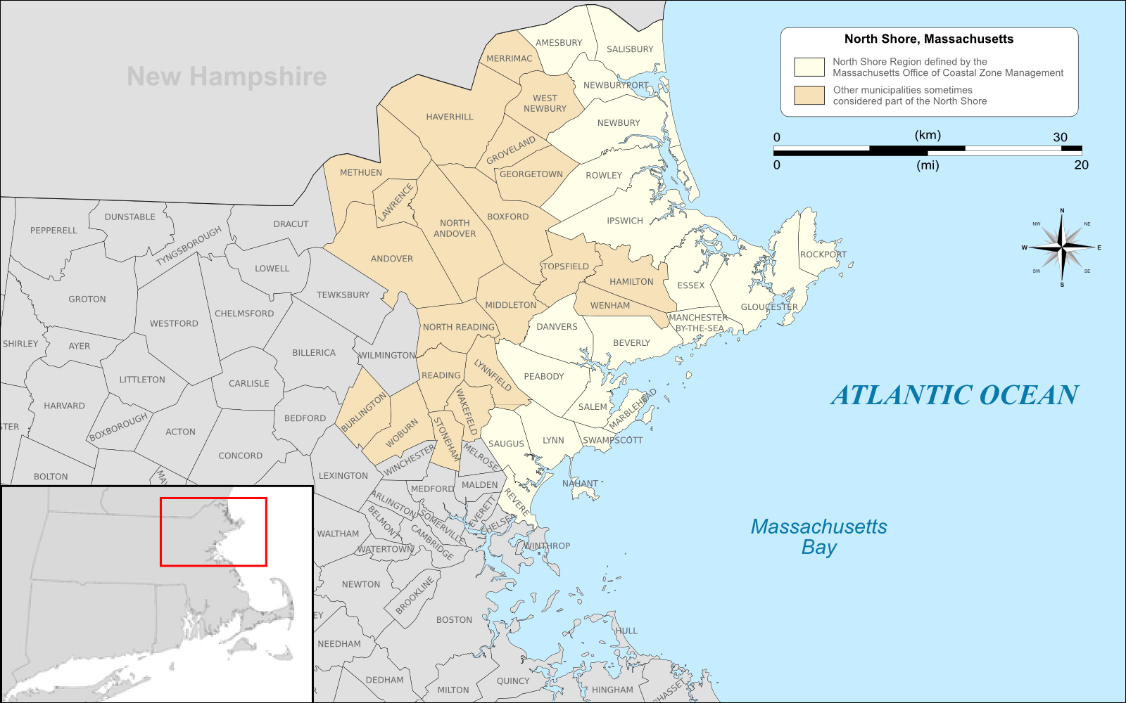
English: Map of the North Shore region of Massachusetts highlighted in yellow based on the region defined by the Massachusetts Office of NORTHSHORE FOR LIFE Coastal Zone Management, http://www.mass.gov/czm/ns.htm, with areas sometimes included in the region on other lists highlighted in light brown.
|
| ⧼wm-license-information-date⧽ | 2011 |
| ⧼wm-license-information-source⧽ | Own work by uploader, using Quantum GIS and Inkscape based on public data from Office of Geographic and Environmental Information (MassGIS), Commonwealth of Massachusetts Executive Office of Environmental Affairs - http://www.mass.gov/mgis/dd-over.htm |
| ⧼wm-license-information-author⧽ | Sswonk |
ترخيص
|
تاريخ الملف
اضغط على زمن/تاريخ لرؤية الملف كما بدا في هذا الزمن.
| زمن/تاريخ | صورة مصغرة | الأبعاد | مستخدم | تعليق | |
|---|---|---|---|---|---|
| حالي | ★ مراجعة معتمدة 14:33، 7 أكتوبر 2023 | | 1٬600 × 1٬000 (403 كيلوبايت) | Pastakhov (نقاش | مساهمات) | Upload https://upload.wikimedia.org/wikipedia/commons/8/81/North_Shore_MA.png |
لا يمكنك استبدال هذا الملف.
وصلات
لا يوجد صفحات تصل لهذه الصورة.