ملف:Norfolk Arms, Handsworth - geograph.org.uk - 72248.jpg
لا توجد دقة أعلى متوفرة.
Norfolk_Arms,_Handsworth_-_geograph.org.uk_-_72248.jpg (640 × 479 بكسل حجم الملف: 89 كيلوبايت، نوع MIME: image/jpeg)
وصف قصير
| ⧼wm-license-information-description⧽ |
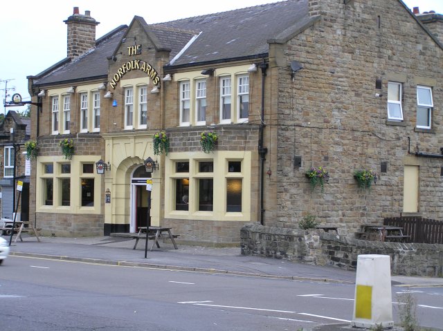
English: Norfolk Arms, Handsworth. One of the old pubs in the area, the Norfolk Arms is identified on the 1901 OS map. Just down the road from here, Benjamin Huntsman, inventor of crucible steel lived for a while in 1742,
|
| ⧼wm-license-information-date⧽ | 2005 |
| ⧼wm-license-information-source⧽ | From geograph.org.uk |
| ⧼wm-license-information-author⧽ | David Morris |
| ⧼wm-license-cc-attribution⧽ (قالب:I18n/Credit line) |
David Morris / Norfolk Arms, Handsworth / |
53°22′31″N 1°23′35″W / 53.3752°N 1.393°W قالب:Object location
)
ترخيص
تاريخ الملف
اضغط على زمن/تاريخ لرؤية الملف كما بدا في هذا الزمن.
| زمن/تاريخ | صورة مصغرة | الأبعاد | مستخدم | تعليق | |
|---|---|---|---|---|---|
| حالي | ★ مراجعة معتمدة 19:27، 28 نوفمبر 2023 | | 640 × 479 (89 كيلوبايت) | Pastakhov (نقاش | مساهمات) | Upload https://upload.wikimedia.org/wikipedia/commons/b/ba/Norfolk_Arms%2C_Handsworth_-_geograph.org.uk_-_72248.jpg |
لا يمكنك استبدال هذا الملف.
وصلات
لا يوجد صفحات تصل لهذه الصورة.