ملف:NevilleIslandBridgePA.jpg
لا توجد دقة أعلى متوفرة.
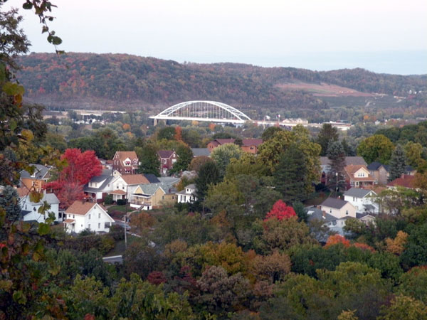
NevilleIslandBridgePA.jpg (600 × 450 بكسل حجم الملف: 100 كيلوبايت، نوع MIME: image/jpeg)
وصف قصير
| ⧼wm-license-information-description⧽ |
English: Picture of the Neville Island Bridge on October 18, 2009. This tied-arch bridge carries Interstate 79 and the Yellow Belt across the Ohio River and over Neville Island, west of Pittsburgh, Pennsylvania. This image was taken on top of the hill (approximately near 310 Park Drive) next to Cornell School District's High School Offices in Coraopolis, Pennsylvania.
|
| ⧼wm-license-information-date⧽ | 2009 |
| ⧼wm-license-information-source⧽ | Photo by Lee Paxton (قالب:Original text) |
| ⧼wm-license-information-author⧽ | Lee Paxton |
40°30′47.88″N 80°8′4.92″W / 40.5133000°N 80.1347000°W
ترخيص
|

قالب:Original upload log
قالب:Original description page
- 2009-10-19 20:43 Leepaxton 600×450× (102116 bytes) {{Information |Description=Picture of the [[Neville Island Bridge]] on October 18, 2009. This [[tied arch bridge]] carries [[Interstate 79]] and the [[Yellow Belt]] across the [[Ohio River]] and over [[Neville Township, Pennsylvania|Neville Island]], wes
تاريخ الملف
اضغط على زمن/تاريخ لرؤية الملف كما بدا في هذا الزمن.
| زمن/تاريخ | صورة مصغرة | الأبعاد | مستخدم | تعليق | |
|---|---|---|---|---|---|
| حالي | ★ مراجعة معتمدة 15:55، 14 نوفمبر 2023 | | 600 × 450 (100 كيلوبايت) | Pastakhov (نقاش | مساهمات) | Upload https://upload.wikimedia.org/wikipedia/commons/f/f7/NevilleIslandBridgePA.jpg |
لا يمكنك استبدال هذا الملف.
وصلات
لا يوجد صفحات تصل لهذه الصورة.