ملف:Naturraum Ries.png
حجم هذه المعاينة: 780 × 599 بكسل. البعد الآخر: 1٬200 × 922 بكسل.
الملف الأصلي (1٬200 × 922 بكسل حجم الملف: 1٫47 ميجابايت، نوع MIME: image/png)
وصف قصير
| ⧼wm-license-information-description⧽ |
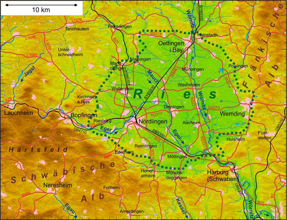
Deutsch: Topografie und Lage des Naturraums Nördlinger Ries
English: Topography and position of the natural space Nördlinger Ries
|
| ⧼wm-license-information-date⧽ | 2018 |
| ⧼wm-license-information-source⧽ | ⧼Wm-license-own-work⧽
Map was created using:
|
| ⧼wm-license-information-author⧽ | Periphrastika |
| ⧼wm-license-information-permission⧽ (⧼wm-license-information-permission-reusing-text⧽) |
|
ترخيص
|
تاريخ الملف
اضغط على زمن/تاريخ لرؤية الملف كما بدا في هذا الزمن.
| زمن/تاريخ | صورة مصغرة | الأبعاد | مستخدم | تعليق | |
|---|---|---|---|---|---|
| حالي | ★ مراجعة معتمدة 08:03، 2 ديسمبر 2023 | | 1٬200 × 922 (1٫47 ميجابايت) | Pastakhov (نقاش | مساهمات) | Upload https://upload.wikimedia.org/wikipedia/commons/0/0d/Naturraum_Ries.png |
لا يمكنك استبدال هذا الملف.
وصلات
لا يوجد صفحات تصل لهذه الصورة.