ملف:NE Dominion.png
حجم هذه المعاينة: 800 × 569 بكسل. البعد الآخر: 1٬355 × 963 بكسل.
الملف الأصلي (1٬355 × 963 بكسل حجم الملف: 213 كيلوبايت، نوع MIME: image/png)
وصف قصير
| ⧼wm-license-information-description⧽ |
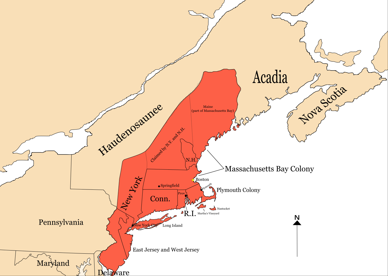
English: Map of the Dominion of New England, as of 1688. At the time, Martha's Vineyard and Nantucket were part of New York, and Delaware was leased to (and shared a legislature with) Pennsylvania. Some of the borders shown were disputed at the time, and some were later adjusted.
|
| ⧼wm-license-information-date⧽ | 2020 |
| ⧼wm-license-information-source⧽ | ⧼Wm-license-own-work⧽ |
| ⧼wm-license-information-author⧽ | Tpwissaa |
ترخيص
|
تاريخ الملف
اضغط على زمن/تاريخ لرؤية الملف كما بدا في هذا الزمن.
| زمن/تاريخ | صورة مصغرة | الأبعاد | مستخدم | تعليق | |
|---|---|---|---|---|---|
| حالي | ★ مراجعة معتمدة 21:04، 14 يناير 2024 | | 1٬355 × 963 (213 كيلوبايت) | Pastakhov (نقاش | مساهمات) | Upload https://upload.wikimedia.org/wikipedia/commons/b/ba/NE_Dominion.png |
لا يمكنك استبدال هذا الملف.
وصلات
لا يوجد صفحات تصل لهذه الصورة.