ملف:Municipal district Prague Dolní Chabry.png
لا توجد دقة أعلى متوفرة.
Municipal_district_Prague_Dolní_Chabry.png (544 × 399 بكسل حجم الملف: 14 كيلوبايت، نوع MIME: image/png)
| ⧼wm-license-information-description⧽ |
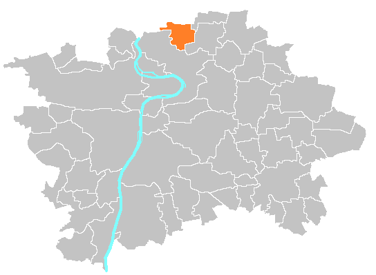
(بالتشيكية) English: Location map of municipal district Prague-Dolní Chabry
|
| ⧼wm-license-information-date⧽ | 2010-05-07 11:12 (UTC) |
| ⧼wm-license-information-source⧽ | |
| ⧼wm-license-information-author⧽ |
|
| [This is a retouched picture, which means that it has been digitally altered from its original version. Modifications: different district highlighted. The original can be viewed here: Location_map_municipal_district_Prague_-_Praha_2.PNG. Modifications made by Ulathaar.] Error: {{Lang}}: text has italic markup (help)
|
قالب:Original upload log
This image is a derivative work of the following images:
- File:Location_map_municipal_district_Prague_-_Praha_2.PNG licensed with PD-self
- 2007-09-19T19:47:39Z Michiel1972 544x399 (17272 Bytes) {{Information |Description=Location map municipal district Prague |Source=self-made, based on [[:image:Prague_municipal_districts.png]] |Date= |Author= [[User:Michiel1972|Michiel1972]] }} [[Category:Maps of Prague]]
تاريخ الملف
اضغط على زمن/تاريخ لرؤية الملف كما بدا في هذا الزمن.
| زمن/تاريخ | صورة مصغرة | الأبعاد | مستخدم | تعليق | |
|---|---|---|---|---|---|
| حالي | ★ مراجعة معتمدة 21:31، 8 ديسمبر 2023 | | 544 × 399 (14 كيلوبايت) | Pastakhov (نقاش | مساهمات) | Upload https://upload.wikimedia.org/wikipedia/commons/c/c2/Municipal_district_Prague_Doln%C3%AD_Chabry.png |
لا يمكنك استبدال هذا الملف.
وصلات
لا يوجد صفحات تصل لهذه الصورة.