ملف:Montbouy - 06.jpg

حجم هذه المعاينة: 800 × 600 بكسل. البعدان الآخران: 2٬560 × 1٬920 بكسل | 3٬120 × 2٬340 بكسل.
الملف الأصلي (3٬120 × 2٬340 بكسل حجم الملف: 5٫08 ميجابايت، نوع MIME: image/jpeg)
وصف قصير
| ⧼wm-license-information-description⧽ |
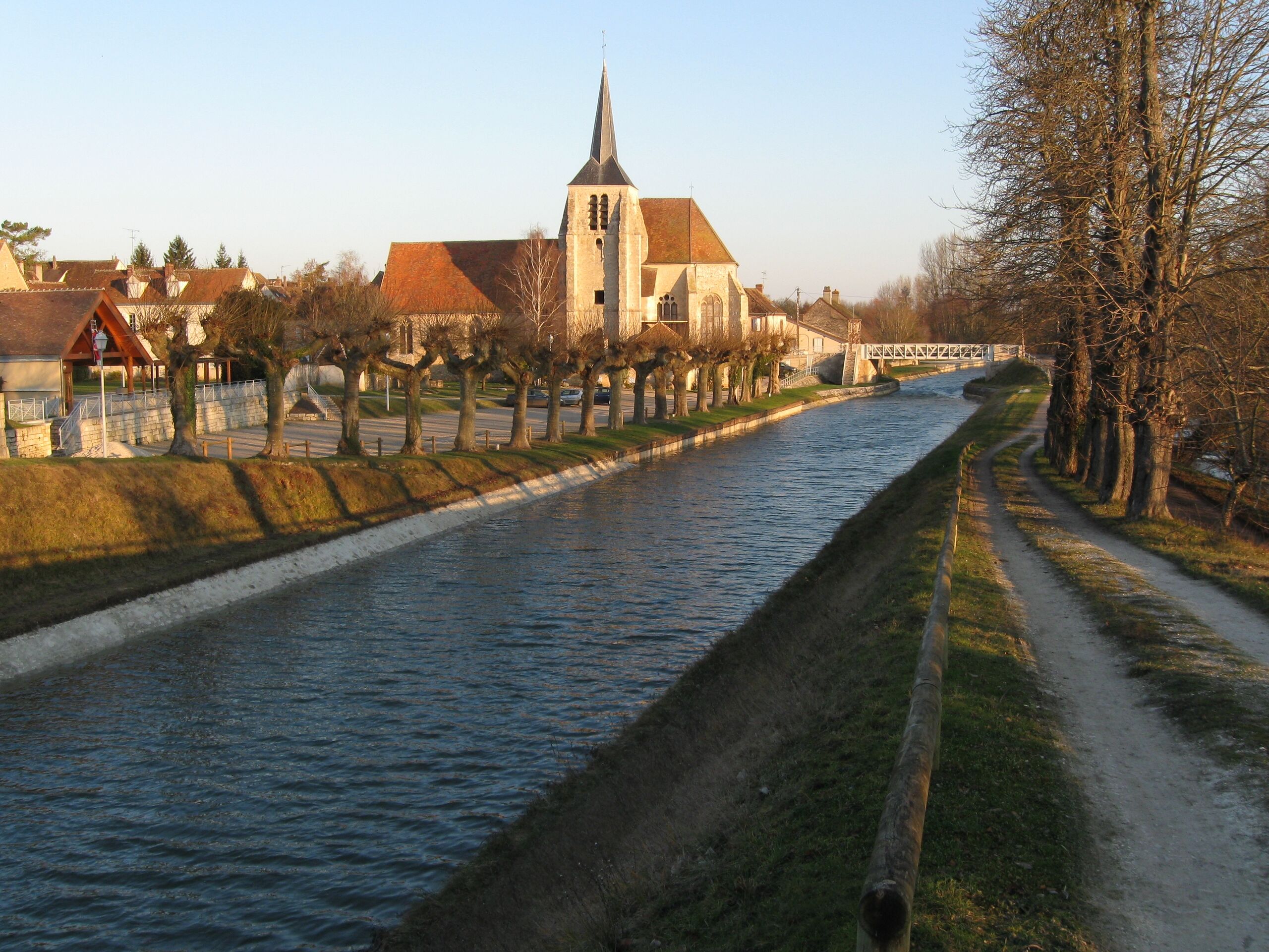
English: Montbouy, Loiret, Centre region, France. The church, view from the south ; and the towing path along the canal. This photo was taken from a point level with the top of the present lock the highest lock on the river Loing (7 m high). The parking lot behind the row of trees along the left of the canal, was built over the old canal port after the canal was slightly moved (towards the right of the photo) at the end of 19th century. One of the old locks' structure (there were two locks in Montbouy, previously to the change in the canal's course) is still visible immediately beside the present day lock.
Français : Montbouy, Loiret, région Centre, France. L'église, vue du sud ; et le chemin de halage du canal de Briare. Vue depuis la hauteur de l'écluse actuelle, la plus haute sur le canal de Briare (7 m hauteur). Le parking derrière la rangée d'arbres le long du canal (ici à droite du canal), a été construit sur le remblaiement de l'ancien port, après que le cours du canal ait été légèrement dévié à la fin du XIXe siècle. La structure de l'une des deux anciennes écluses (Montbouy en avait deux) est toujours visible immédiatement à côté de l'écluse moderne.
|
| ⧼wm-license-information-date⧽ | 2008 |
| ⧼wm-license-information-source⧽ | ⧼Wm-license-own-work⧽ |
| ⧼wm-license-information-author⧽ | Alvaro |
47°51′35″N 02°49′14″E / 47.85972°N 2.82056°E
ترخيص
|

تاريخ الملف
اضغط على زمن/تاريخ لرؤية الملف كما بدا في هذا الزمن.
| زمن/تاريخ | صورة مصغرة | الأبعاد | مستخدم | تعليق | |
|---|---|---|---|---|---|
| حالي | ★ مراجعة معتمدة 22:33، 13 نوفمبر 2023 | | 3٬120 × 2٬340 (5٫08 ميجابايت) | Pastakhov (نقاش | مساهمات) | Upload https://upload.wikimedia.org/wikipedia/commons/6/62/Montbouy_-_06.jpg |
لا يمكنك استبدال هذا الملف.
وصلات
لا يوجد صفحات تصل لهذه الصورة.