ملف:Moncada,Tarlacjf5974 01.JPG

حجم هذه المعاينة: 800 × 600 بكسل. البعدان الآخران: 2٬560 × 1٬920 بكسل | 4٬608 × 3٬456 بكسل.
الملف الأصلي (4٬608 × 3٬456 بكسل حجم الملف: 6٫37 ميجابايت، نوع MIME: image/jpeg)
وصف قصير
| ⧼wm-license-information-description⧽ |
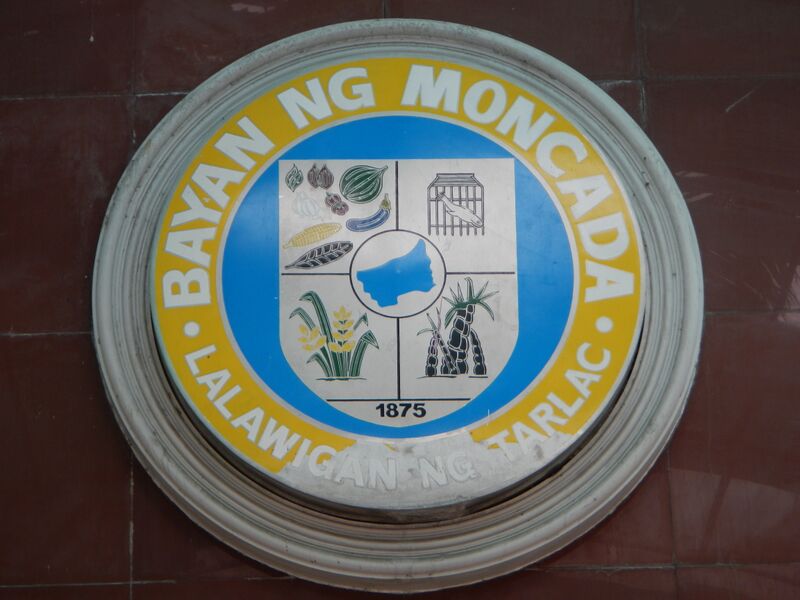
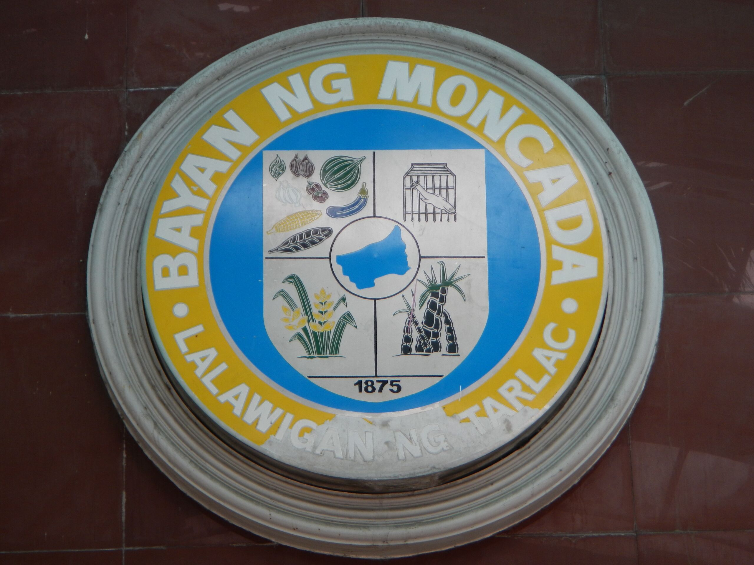
English: Moncada, Tarlac[1] is a first class municipality in the province of Tarlac, Philippines. According to the 2010 census, it has a population of 56,183 people. The economy is primarily based on agriculture with rice, corn, vegetables, root crops, watermelons, mangoes as major products. The fishery sector, once a vibrant source of food and income needs rehabilitation after the onslaught of lahar flows resulting from the Mt. Pinatubo eruption. There is a growing retail and service sector in the "poblaciones" along the national highway. Light industries are yet to evolve in the municipality to generate much needed employment. Ilocano is commonly spoken, with Tagalog and English as official languages used for secondary education, business and governance.[2] [3] [4]Land Area: 85.75 km² ZIP Code: 2308 Coordinates: 15°45'48"N 120°32'37"E [5] This place is situated in Tarlac, Region 3, Philippines, its geographical coordinates are 15° 44' 12" North, 120° 34' 28" East and its original name (with diacritics) is Moncada. MONCADA: AN EMERGING EMPORIUM OF COMMERCE AND TRADE FAIRS - In the early years of the 1860s, four families from the barrio of Magaspac, Gerona, surreptitiously left their homes for fear of the Spanish curate, Father Modesto Perez. They settled in Sitio Caarosipan, the northern part of Paniqui. When the place became flooded and their crops were destroyed, they sought higher grounds and resettled in Sitio Payakan. The bounties of the place attracted other people from Pangasinan and Ilocos. These people joined those who were from Magaspac. Its people being hardworking, the sitio grew into a town. Later, it was named San Ramon in honor of their patron, Saint Raymond Nonnatus. On May 1, 1845, a royal decree was issued by the Ministerio de Ultramar converting San Ramon into a town independent from its mother town, Paniqui and changing its name to Moncada. Moncada lies in the northern part of Tarlac. It is bounded in the North by the municipality of San Manuel, in the West by Camiling, in the East by Anao, and in the South by Paniqui. It is comprised of 33 agricultural barangays and 4 poblacions with a total area of 8,575 hectares. A third class municipality, it has a population of 49,607 people in 10,144 households (NSO, 200). Beyond its traditional tobacco crops, Moncada is fast emerging as an emporium of commerce and trade fairs in the province today. Trade fairs enliven the industrial and technological ingenuities of the Tarlaquenos as craftsmen and entrepreneurs. As a manifestation of economic synergism, Moncada continues to strive forward towards progress and development and beyond time and standards. As an effect, the dignity of every Moncadeno benefits from the fruits of the town’s budding boom and economy.[6] [7]
|
| ⧼wm-license-information-date⧽ | 2013, {{time}} – invalid date format 04 (help) |
| ⧼wm-license-information-source⧽ | ⧼Wm-license-own-work⧽ |
| ⧼wm-license-information-author⧽ | Ramon FVelasquez |
ترخيص
|
تاريخ الملف
اضغط على زمن/تاريخ لرؤية الملف كما بدا في هذا الزمن.
| زمن/تاريخ | صورة مصغرة | الأبعاد | مستخدم | تعليق | |
|---|---|---|---|---|---|
| حالي | ★ مراجعة معتمدة 15:01، 14 أكتوبر 2023 | | 4٬608 × 3٬456 (6٫37 ميجابايت) | Pastakhov (نقاش | مساهمات) | Upload https://upload.wikimedia.org/wikipedia/commons/8/8e/Moncada%2CTarlacjf5974_01.JPG |
لا يمكنك استبدال هذا الملف.
وصلات
لا يوجد صفحات تصل لهذه الصورة.