ملف:Milford Bird's-Eye View crop.jpg
حجم هذه المعاينة: 800 × 447 بكسل. البعد الآخر: 2٬513 × 1٬404 بكسل.
الملف الأصلي (2٬513 × 1٬404 بكسل حجم الملف: 3٫35 ميجابايت، نوع MIME: image/jpeg)
| ⧼wm-license-information-description⧽ |
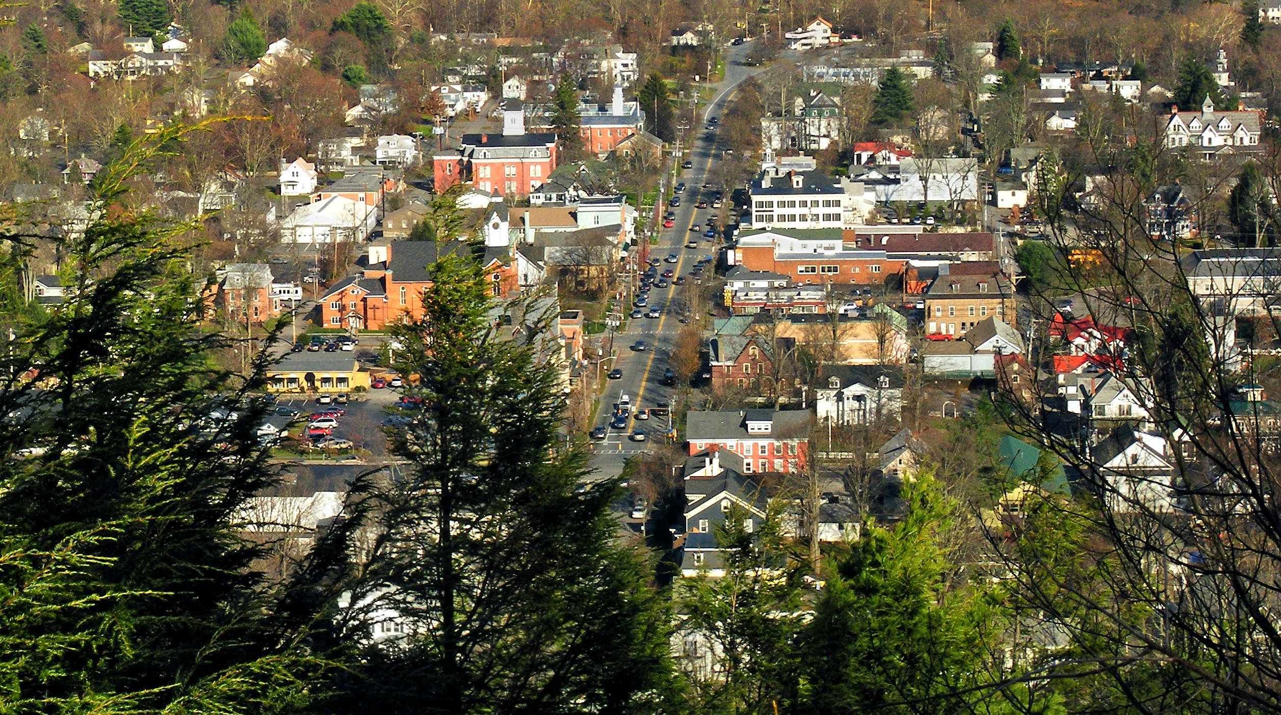
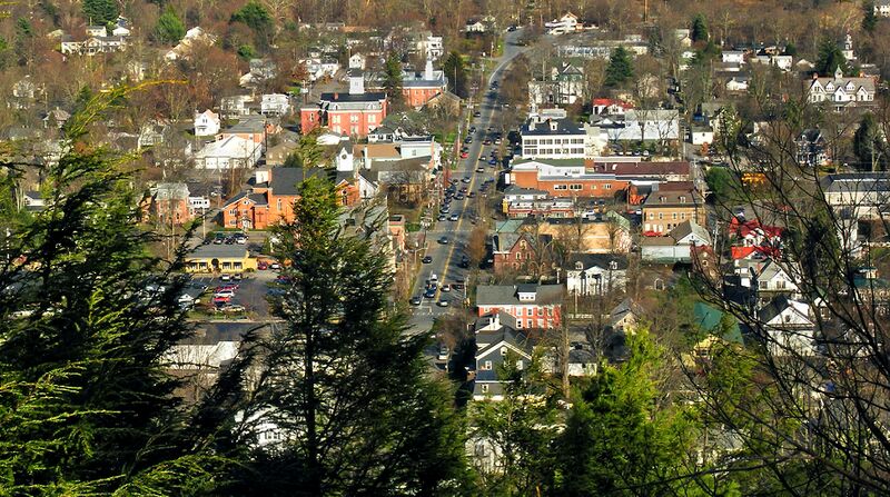
Milford, Pike County. The Cliff Trail, part of the Delaware Water Gap National Recreation Area, provides many outstanding views of the Delaware River Valley. The vista here is from a prominent escarpment known locally as the Knob. Running vertically through town is US Route 6; along the ridge (but mostly hidden from view) is Interstate 84. |
||
| ⧼wm-license-information-date⧽ | 2009, {{time}} – invalid date format 59 (help) | ||
| ⧼wm-license-information-source⧽ | originally posted to Flickr as Bird's-Eye View | ||
| ⧼wm-license-information-author⧽ | Nicholas; cropped by Beyond My Ken (talk) 23:22, 27 September 2011 (UTC) | ||
| ⧼wm-license-information-permission⧽ (⧼wm-license-information-permission-reusing-text⧽) |
مستخدم:Flickr upload bot/upload |
||
| ⧼wm-license-information-other-versions⧽ |
تاريخ الملف
اضغط على زمن/تاريخ لرؤية الملف كما بدا في هذا الزمن.
| زمن/تاريخ | صورة مصغرة | الأبعاد | مستخدم | تعليق | |
|---|---|---|---|---|---|
| حالي | ★ مراجعة معتمدة 21:49، 11 نوفمبر 2023 | | 2٬513 × 1٬404 (3٫35 ميجابايت) | Pastakhov (نقاش | مساهمات) | Upload https://upload.wikimedia.org/wikipedia/commons/5/5a/Milford_Bird%27s-Eye_View_crop.jpg |
لا يمكنك استبدال هذا الملف.
وصلات
لا يوجد صفحات تصل لهذه الصورة.