ملف:Mediterranean Sea political map-es.svg

حجم معاينة PNG لذلك الملف ذي الامتداد SVG: 800 × 585 بكسل. البعد الآخر: 2٬560 × 1٬872 بكسل.
الملف الأصلي (ملف SVG، أبعاده 2٬046 × 1٬496 بكسل، حجم الملف: 1٫1 ميجابايت)
| ⧼wm-license-information-description⧽ |
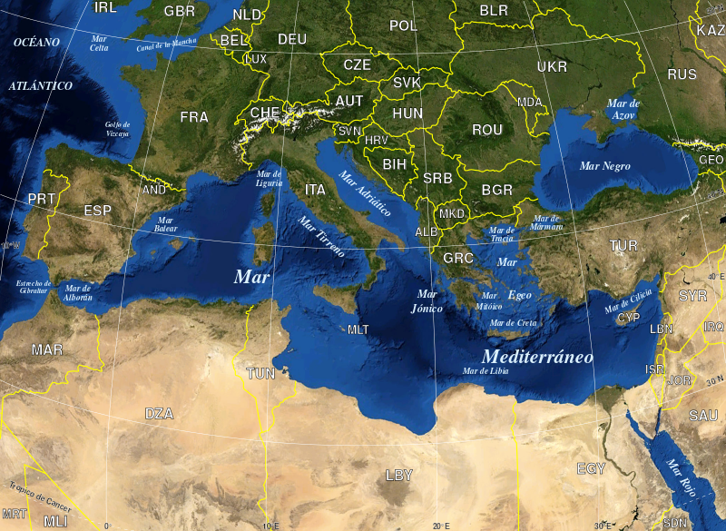
English: Map in Spanish of the Mediterranean Sea, with the borders and the name of the States following the ISO 3166-1 Alpha-3 code. Español: Mapa en español del Mar Mediterraneo con las fronteras y los nombres de los estados siguiendo el código ISO 3166-1 Alpha-3.
|
| ⧼wm-license-information-date⧽ | 2010-06-13 18:11 (UTC) |
| ⧼wm-license-information-source⧽ | |
| ⧼wm-license-information-author⧽ |
|
| [This is a retouched picture, which means that it has been digitally altered from its original version. Modifications: Versión en español. The original can be viewed here: Mediterranean_Sea_political_map-en.svg. Modifications made by edoarado.] Error: {{Lang}}: text has italic markup (help)
|
قالب:PD-WorldWindقالب:PD-retouched-user-w
قالب:Original upload log
This image is a derivative work of the following images:
- File:Mediterranean_Sea_political_map-en.svg licensed with PD-WorldWind, PD-retouched-user-w
- 2008-05-19T16:18:12Z Sting 2046x1496 (1148854 Bytes) "Tropic of Cancer" label correction
- 2007-06-21T01:01:36Z Sting 2046x1496 (1148419 Bytes) {{Information |Description=Map in English of the [[:en:Mediterranean Sea|Mediterranean Sea]], with the borders and the name of the States following the ISO 3166-1 Alpha-3 code. |Source=Own work ;Background map : screenshot fr
تاريخ الملف
اضغط على زمن/تاريخ لرؤية الملف كما بدا في هذا الزمن.
| زمن/تاريخ | صورة مصغرة | الأبعاد | مستخدم | تعليق | |
|---|---|---|---|---|---|
| حالي | ★ مراجعة معتمدة 14:14، 6 أكتوبر 2023 | | 2٬046 × 1٬496 (1٫1 ميجابايت) | Pastakhov (نقاش | مساهمات) | Upload https://upload.wikimedia.org/wikipedia/commons/8/8c/Mediterranean_Sea_political_map-es.svg |
لا يمكنك استبدال هذا الملف.
وصلات
لا يوجد صفحات تصل لهذه الصورة.