ملف:Mediterranean Sea Bathymetry map.svg

حجم معاينة PNG لذلك الملف ذي الامتداد SVG: 800 × 376 بكسل. البعد الآخر: 2٬560 × 1٬204 بكسل.
الملف الأصلي (ملف SVG، أبعاده 4٬252 × 2٬000 بكسل، حجم الملف: 4٫3 ميجابايت)
وصف قصير
| ⧼wm-license-information-description⧽ |
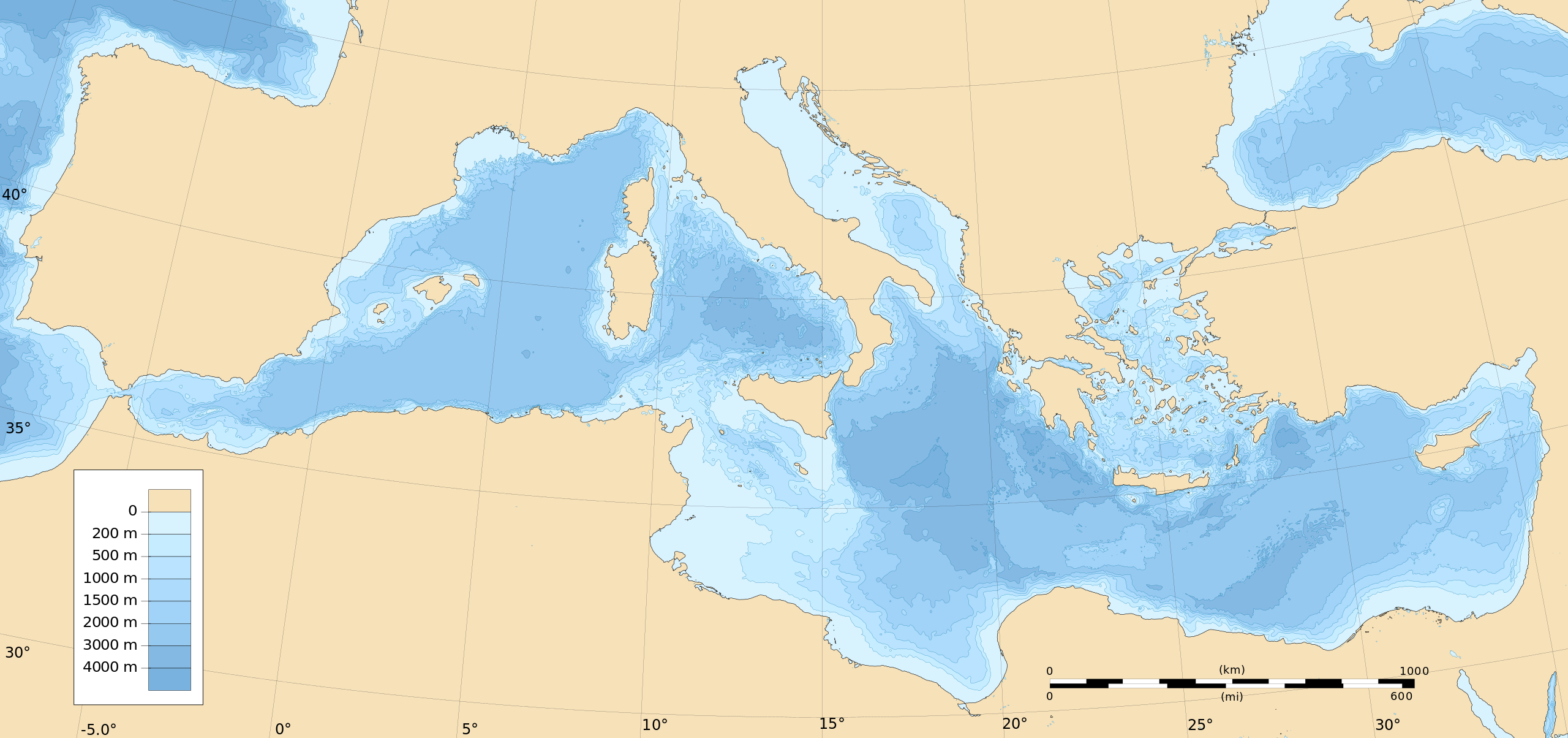
English: Bathymetry map of the Mediterranean Sea.
UTM projection, WGS84 datum Geographic limits of the map:
|
| ⧼wm-license-information-date⧽ | 2015 |
| ⧼wm-license-information-source⧽ | ⧼Wm-license-own-work⧽ |
| ⧼wm-license-information-author⧽ | Ikonact |
قالب:Atelier graphique carte قالب:Inkscape-hand
ترخيص
|
تاريخ الملف
اضغط على زمن/تاريخ لرؤية الملف كما بدا في هذا الزمن.
| زمن/تاريخ | صورة مصغرة | الأبعاد | مستخدم | تعليق | |
|---|---|---|---|---|---|
| حالي | ★ مراجعة معتمدة 14:13، 6 أكتوبر 2023 | | 4٬252 × 2٬000 (4٫3 ميجابايت) | Pastakhov (نقاش | مساهمات) | Upload https://upload.wikimedia.org/wikipedia/commons/f/f9/Mediterranean_Sea_Bathymetry_map.svg |
لا يمكنك استبدال هذا الملف.
وصلات
لا يوجد صفحات تصل لهذه الصورة.