ملف:Medelstad Edestad.svg

حجم معاينة PNG لذلك الملف ذي الامتداد SVG: 692 × 599 بكسل. البعد الآخر: 2٬365 × 2٬048 بكسل.
الملف الأصلي (ملف SVG، أبعاده 6٬175 × 5٬347 بكسل، حجم الملف: 4٫34 ميجابايت)
| ⧼wm-license-information-description⧽ |
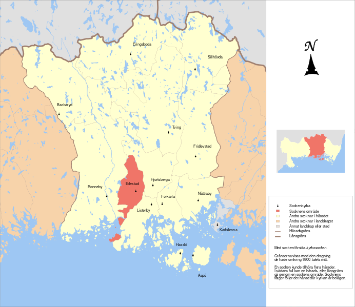
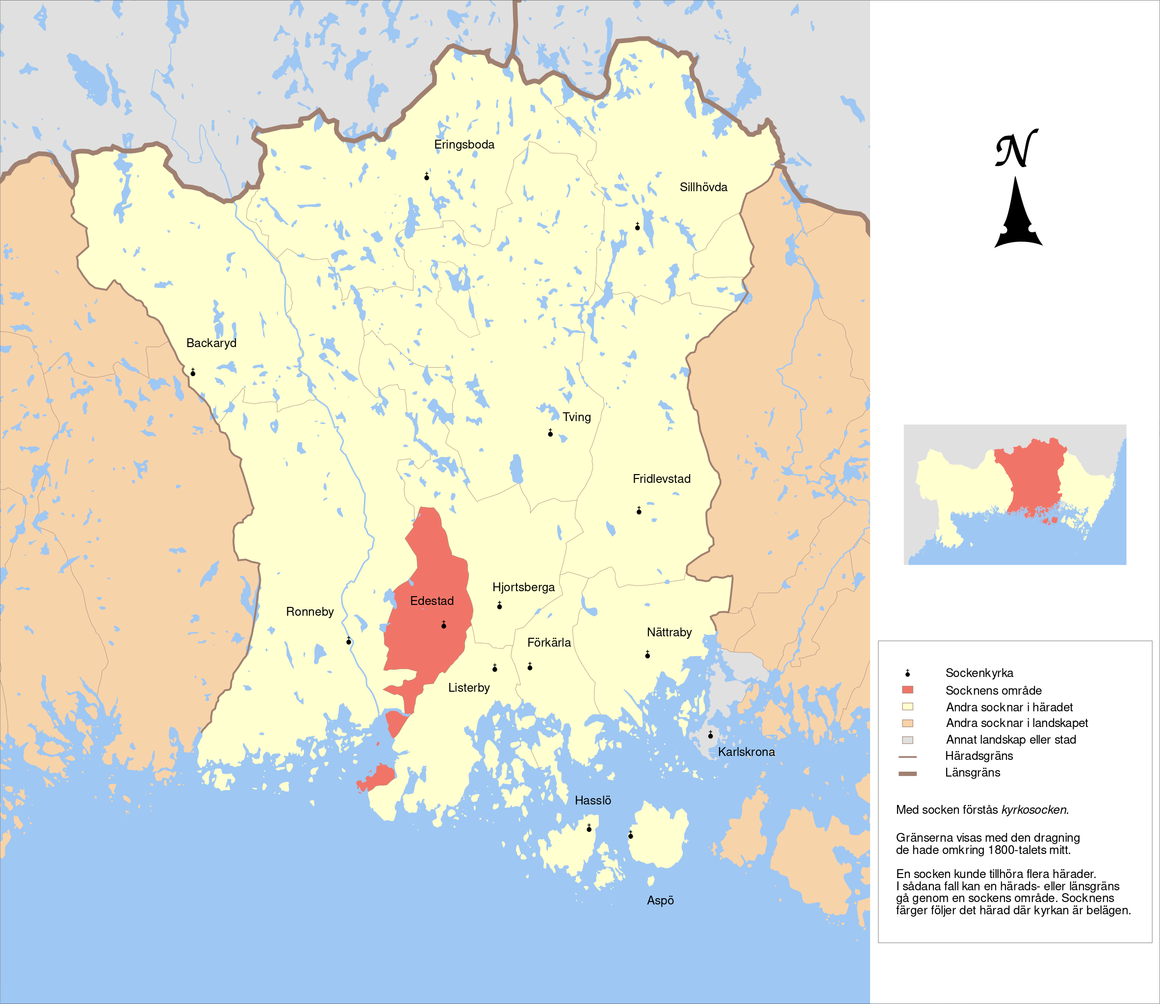
English: Map showing the borders of the civil parish of Edestad in the hundred of Medelstad, Blekinge County, Blekinge Region of Sweden. Circa 1850-1900.
|
| ⧼wm-license-information-date⧽ | 2011-06-02 18:40 (UTC) |
| ⧼wm-license-information-source⧽ | |
| ⧼wm-license-information-author⧽ |
|
| [This is a retouched picture, which means that it has been digitally altered from its original version. Modifications: Combined maps to form the parishes of the hundred of Medelstad. The original can be viewed here: GS_Lessebo.svg. Modifications made by Edaen.] Error: {{Lang}}: text has italic markup (help)
|
|
|
هذا الملفُّ مُرخَّص بموجب رخصة المشاع الإبداعي نسبة المُصنَّف إِلى مؤلفه - المشاركة بالمثل 3.0 العامة. |
قالب:Original upload log
This image is a derivative work of the following images:
- File:GS_Karlshamn.svg licensed with Cc-by-3.0
- 2010-09-29T17:38:30Z Edaen 5930x4415 (751375 Bytes) {{Information |Description={{en|1=Map showing borders of parishes and hundreds in the vicinity of Karlshamn, based on information from map by Topografiska Corpsen. '''10. Karlshamn''' Grav. af Ebbesen. Topografiska Corpsen
- File:GS_Karlskrona.svg licensed with Cc-by-3.0
- 2010-11-06T08:27:27Z Edaen 5943x4457 (713103 Bytes) {{Information |Description={{en|1=Map showing borders of parishes and hundreds in the vicinity of Karlskrona, based on information from map by Topografiska Corpsen. '''11. Karlskrona''' Topografiska Corpsens karta öfver S
- File:GS_Huseby.svg licensed with Cc-by-3.0
- 2010-09-30T16:49:14Z Edaen 5855x4434 (563496 Bytes) {{Information |Description={{en|1=Map showing borders of parishes and hundreds in the vicinity of Karlshamn, based on information from map by Topografiska Corpsen. '''Huseby''' (Vislanda) Grav. af C. Ebbesen Topografiska C
- File:GS_Lessebo.svg licensed with Cc-by-3.0
- 2010-11-01T16:45:21Z Edaen 5931x4421 (481874 Bytes) {{Information |Description={{en|1=Map showing borders of parishes and hundreds in the vicinity of Lessebo, based on information from map by Topografiska Corpsen. '''16. Lessebo''' Graverad af Hagstrand, Wennersten och Ebbe
تاريخ الملف
اضغط على زمن/تاريخ لرؤية الملف كما بدا في هذا الزمن.
| زمن/تاريخ | صورة مصغرة | الأبعاد | مستخدم | تعليق | |
|---|---|---|---|---|---|
| حالي | ★ مراجعة معتمدة 03:23، 17 أكتوبر 2023 | | 6٬175 × 5٬347 (4٫34 ميجابايت) | Pastakhov (نقاش | مساهمات) | Upload https://upload.wikimedia.org/wikipedia/commons/3/3b/Medelstad_Edestad.svg |
لا يمكنك استبدال هذا الملف.
وصلات
لا يوجد صفحات تصل لهذه الصورة.