ملف:Mayotte topographic map-fr.svg

حجم معاينة PNG لذلك الملف ذي الامتداد SVG: 477 × 599 بكسل. البعد الآخر: 1٬631 × 2٬048 بكسل.
الملف الأصلي (ملف SVG، أبعاده 1٬033 × 1٬297 بكسل، حجم الملف: 874 كيلوبايت)
وصف قصير
| ⧼wm-license-information-description⧽ |
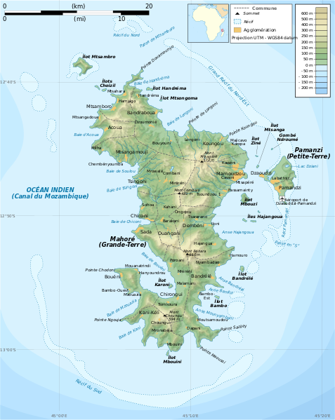
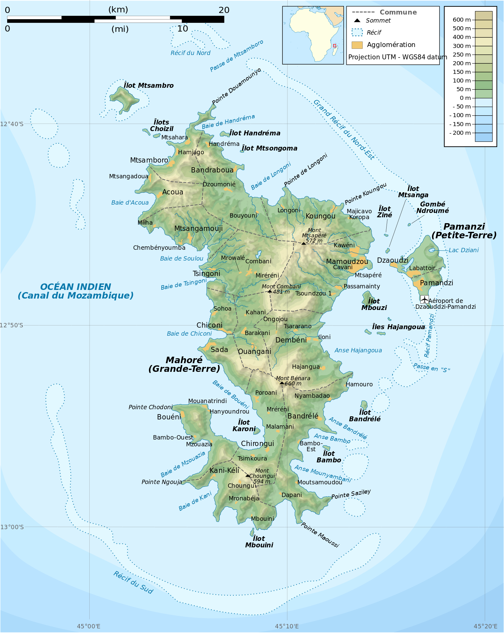
Français : Carte topographique de Mayotte en français. Utiliser la version PNG dans les articles pour un rendu plus rapide.
|
| ⧼wm-license-information-date⧽ | 2009 |
| ⧼wm-license-information-source⧽ | Own work. Sources of data:
|
| ⧼wm-license-information-author⧽ | Rémi Kaupp |
| ⧼wm-license-information-other-versions⧽ |
قالب:Atelier graphique carte مستخدم:Korrigan/maps
ترخيص
|

تاريخ الملف
اضغط على زمن/تاريخ لرؤية الملف كما بدا في هذا الزمن.
| زمن/تاريخ | صورة مصغرة | الأبعاد | مستخدم | تعليق | |
|---|---|---|---|---|---|
| حالي | ★ مراجعة معتمدة 15:53، 12 يناير 2024 | | 1٬033 × 1٬297 (874 كيلوبايت) | Pastakhov (نقاش | مساهمات) | Upload https://upload.wikimedia.org/wikipedia/commons/f/f1/Mayotte_topographic_map-fr.svg |
لا يمكنك استبدال هذا الملف.
وصلات
لا يوجد صفحات تصل لهذه الصورة.