ملف:Martons Both UK parish locator map.svg

حجم معاينة PNG لذلك الملف ذي الامتداد SVG: 800 × 582 بكسل. البعد الآخر: 2٬560 × 1٬863 بكسل.
الملف الأصلي (ملف SVG، أبعاده 1٬425 × 1٬037 بكسل، حجم الملف: 4٫3 ميجابايت)
وصف قصير
| ⧼wm-license-information-description⧽ |
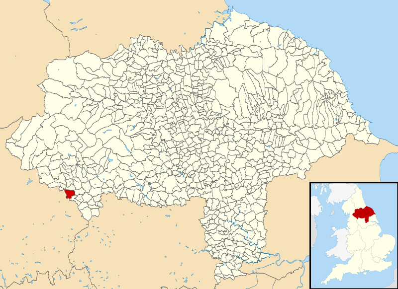
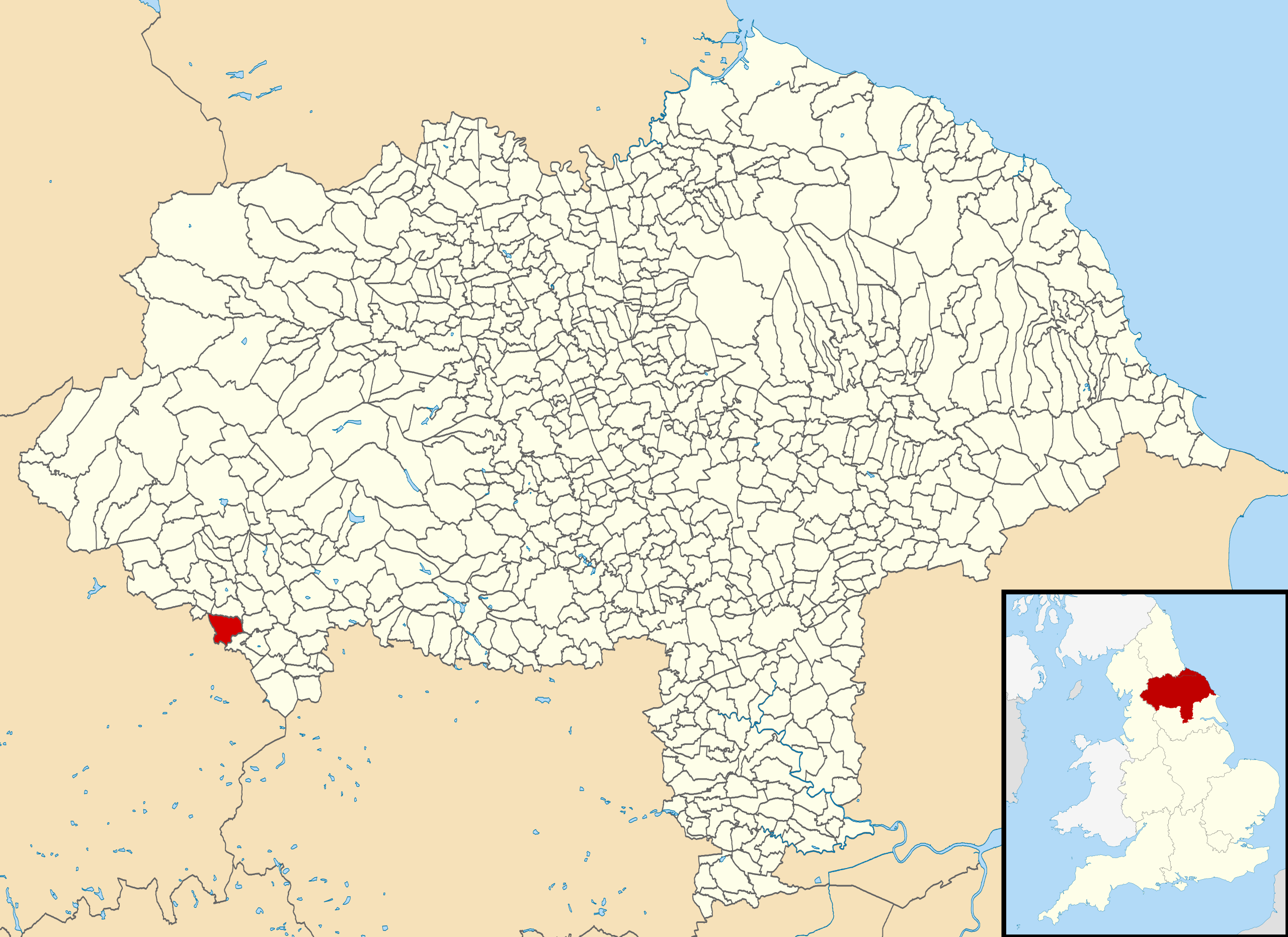
English: Map of North Yorkshire, England, with Martons Both parish highlighted.
Equirectangular map projection on WGS 84 datum, with N/S stretched 165% Geographic limits:
|
||
| ⧼wm-license-information-date⧽ | 2013 | ||
| ⧼wm-license-information-source⧽ | File:North Yorkshire UK parish map (blank).svg | ||
| ⧼wm-license-information-author⧽ |
|
||
| ⧼wm-license-information-permission⧽ (⧼wm-license-information-permission-reusing-text⧽) |
|
.svg&action=edit&redlink=1)
تاريخ الملف
اضغط على زمن/تاريخ لرؤية الملف كما بدا في هذا الزمن.
| زمن/تاريخ | صورة مصغرة | الأبعاد | مستخدم | تعليق | |
|---|---|---|---|---|---|
| حالي | ★ مراجعة معتمدة 22:08، 27 أكتوبر 2023 | | 1٬425 × 1٬037 (4٫3 ميجابايت) | Pastakhov (نقاش | مساهمات) | Upload https://upload.wikimedia.org/wikipedia/commons/0/02/Martons_Both_UK_parish_locator_map.svg |
لا يمكنك استبدال هذا الملف.
وصلات
لا يوجد صفحات تصل لهذه الصورة.