ملف:Maritime Claims of Peru.svg

حجم معاينة PNG لذلك الملف ذي الامتداد SVG: 463 × 600 بكسل. البعد الآخر: 1٬581 × 2٬048 بكسل.
الملف الأصلي (ملف SVG، أبعاده 1٬168 × 1٬513 بكسل، حجم الملف: 181 كيلوبايت)
وصف قصير
| ⧼wm-license-information-description⧽ |
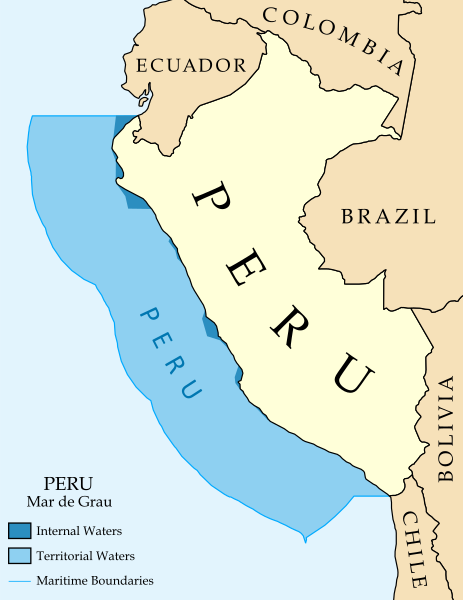
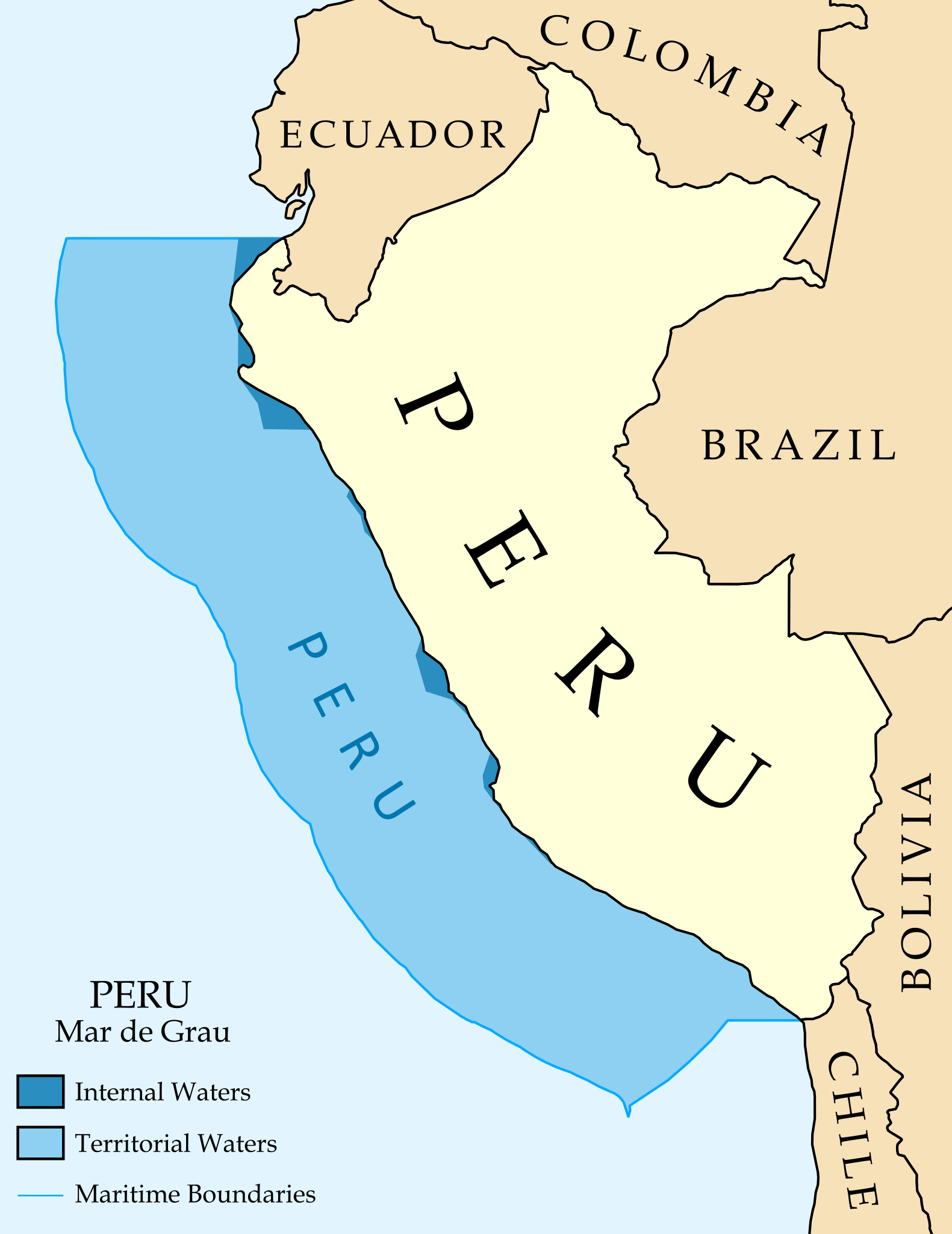
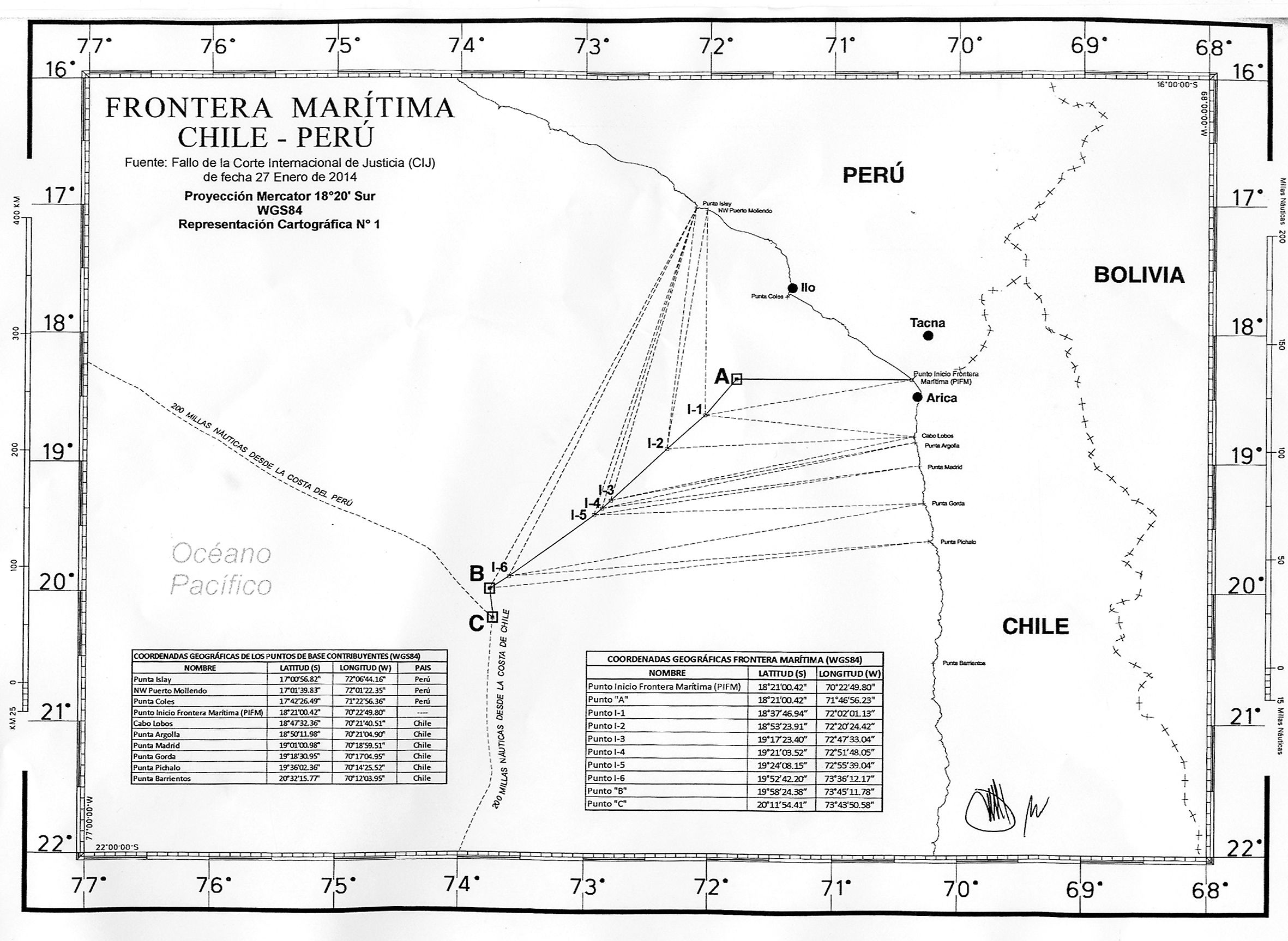
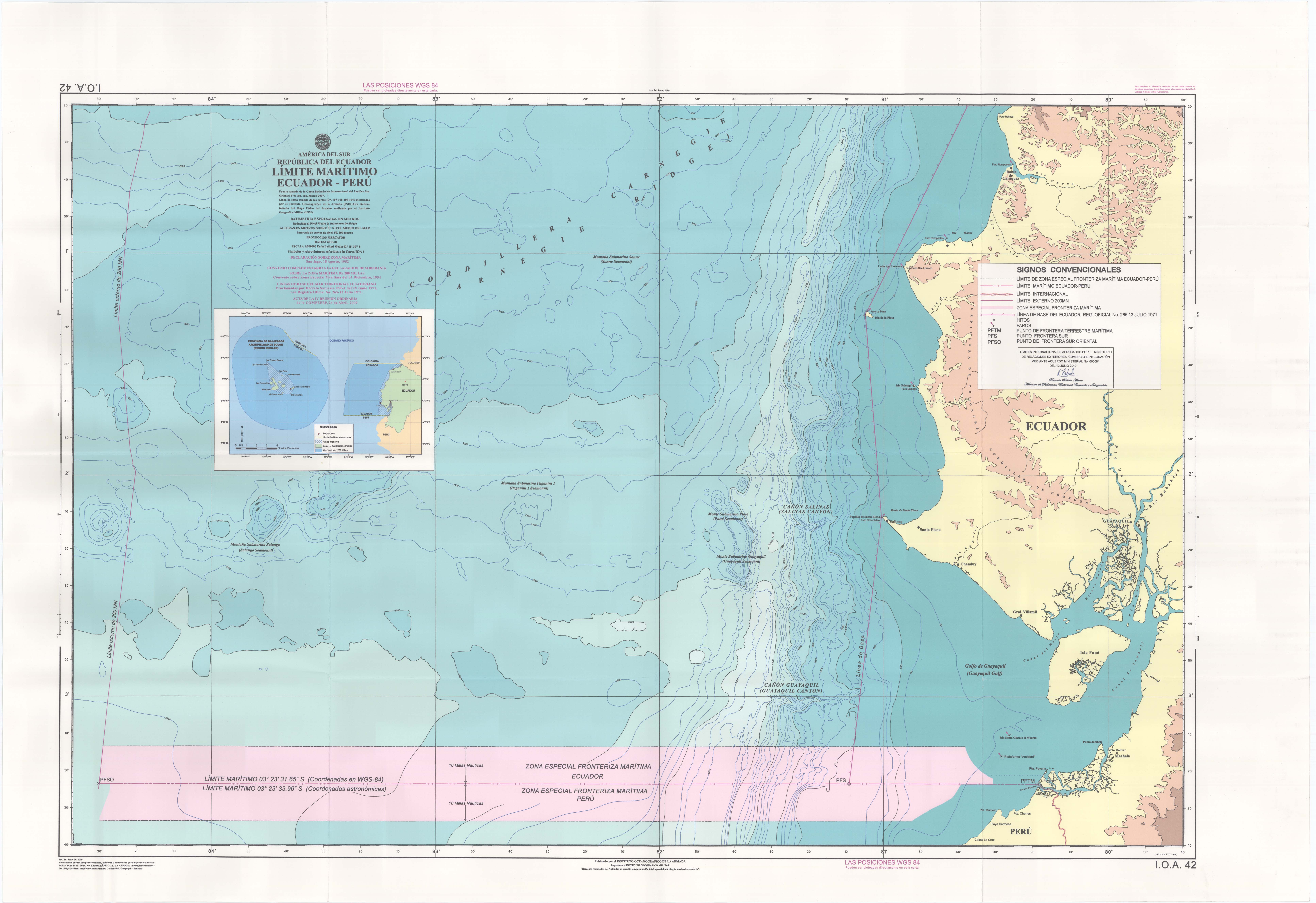
English: Map of the maritime claims of Peru including internal/archipelagic waters, territorial waters, exclusive economic zones (EEZ), and disputed areas.
|
| ⧼wm-license-information-date⧽ | 2014 |
| ⧼wm-license-information-source⧽ | قالب:Derived from
|
| ⧼wm-license-information-author⧽ |
|
ترخيص
|
قالب:Original upload log
This image is a derivative work of the following images:
- File:Maritime_Claims_of_Peru_and_Ecuador.svg licensed with Cc-by-sa-3.0
تاريخ الملف
اضغط على زمن/تاريخ لرؤية الملف كما بدا في هذا الزمن.
| زمن/تاريخ | صورة مصغرة | الأبعاد | مستخدم | تعليق | |
|---|---|---|---|---|---|
| حالي | ★ مراجعة معتمدة 17:14، 18 أكتوبر 2023 | | 1٬168 × 1٬513 (181 كيلوبايت) | Pastakhov (نقاش | مساهمات) | Upload https://upload.wikimedia.org/wikipedia/commons/b/b0/Maritime_Claims_of_Peru.svg |
لا يمكنك استبدال هذا الملف.
وصلات
لا يوجد صفحات تصل لهذه الصورة.