ملف:Mariana trench location.jpg
لا توجد دقة أعلى متوفرة.
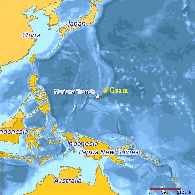
Mariana_trench_location.jpg (400 × 400 بكسل حجم الملف: 59 كيلوبايت، نوع MIME: image/jpeg)

|
[All images in this gallery should be recreated using vector graphics as an SVG file. This has several advantages; see Commons:Media for cleanup for more information. If an SVG form of this image is already available, please upload it. After uploading an SVG, replace this template with {{vector version available|new image name.svg}}.] Error: {{Lang}}: text has italic markup (help) |
|
العربية | български | català | čeština | dansk | Deutsch | English | Esperanto | español | français | galego | 한국어 | italiano | magyar | lietuvių | 日本語 | Plattdüütsch | Nederlands | norsk | polski | português | română | русский | suomi | svenska | Türkçe | українська | 中文(繁體) | 中文(简体) | +/− | |
وصف قصير
The image is copied from the article entitled Mariana Trench in the "English Wikipedia." It is generated by the User Dcfleck at www.planiglobe.com with the licensing, accroding to the original source, as follows.
ترخيص
Planiglobe license: قالب:Planiglobe
تاريخ الملف
اضغط على زمن/تاريخ لرؤية الملف كما بدا في هذا الزمن.
| زمن/تاريخ | صورة مصغرة | الأبعاد | مستخدم | تعليق | |
|---|---|---|---|---|---|
| حالي | ★ مراجعة معتمدة 15:14، 30 نوفمبر 2023 | | 400 × 400 (59 كيلوبايت) | Pastakhov (نقاش | مساهمات) | Upload https://upload.wikimedia.org/wikipedia/commons/1/13/Mariana_trench_location.jpg |
لا يمكنك استبدال هذا الملف.
وصلات
لا يوجد صفحات تصل لهذه الصورة.