ملف:Mariana Trench Map 1907.jpg
حجم هذه المعاينة: 753 × 600 بكسل. البعدان الآخران: 2٬560 × 2٬038 بكسل | 2٬915 × 2٬321 بكسل.
الملف الأصلي (2٬915 × 2٬321 بكسل حجم الملف: 2٫48 ميجابايت، نوع MIME: image/jpeg)
وصف قصير
| ⧼wm-license-information-description⧽ |
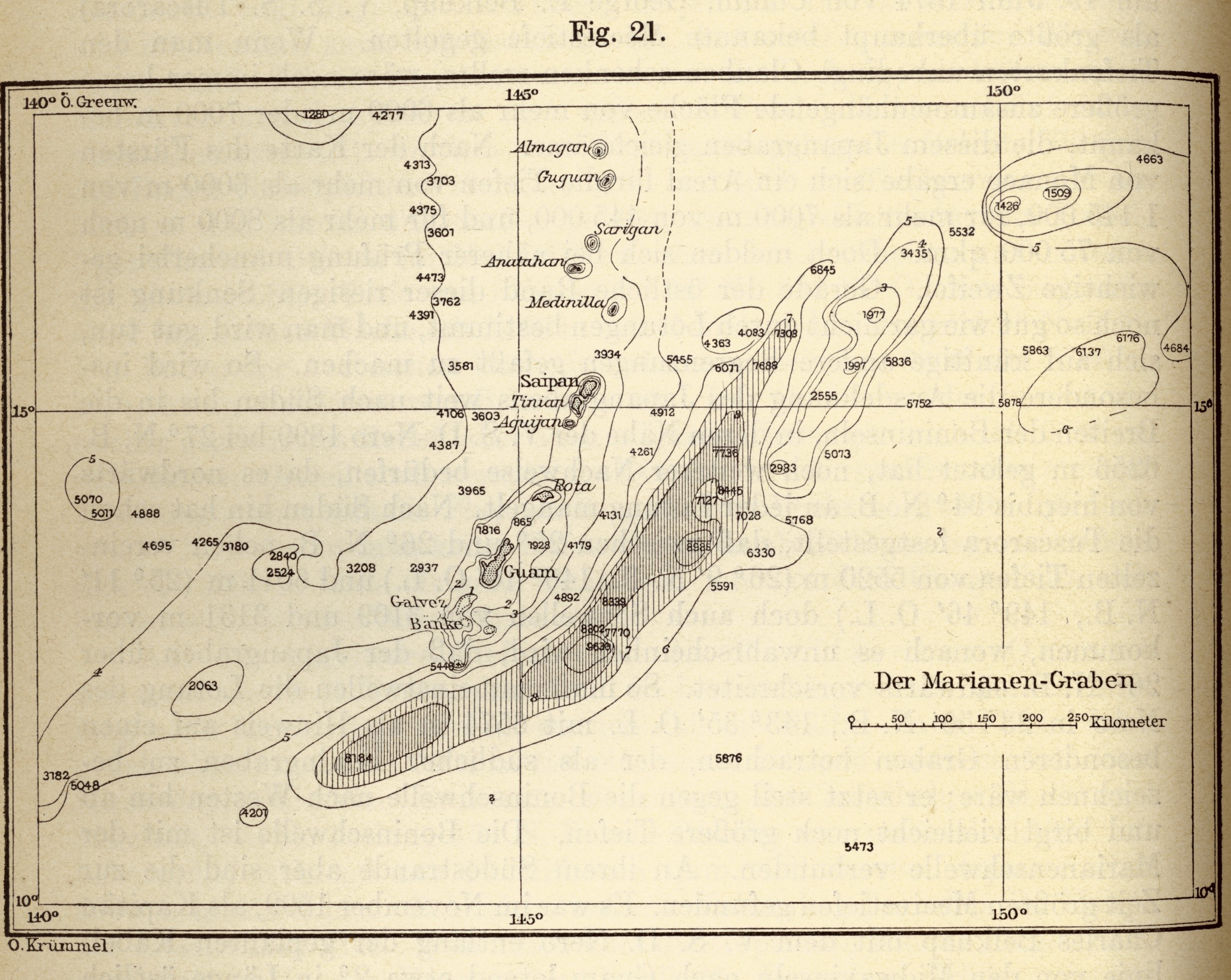
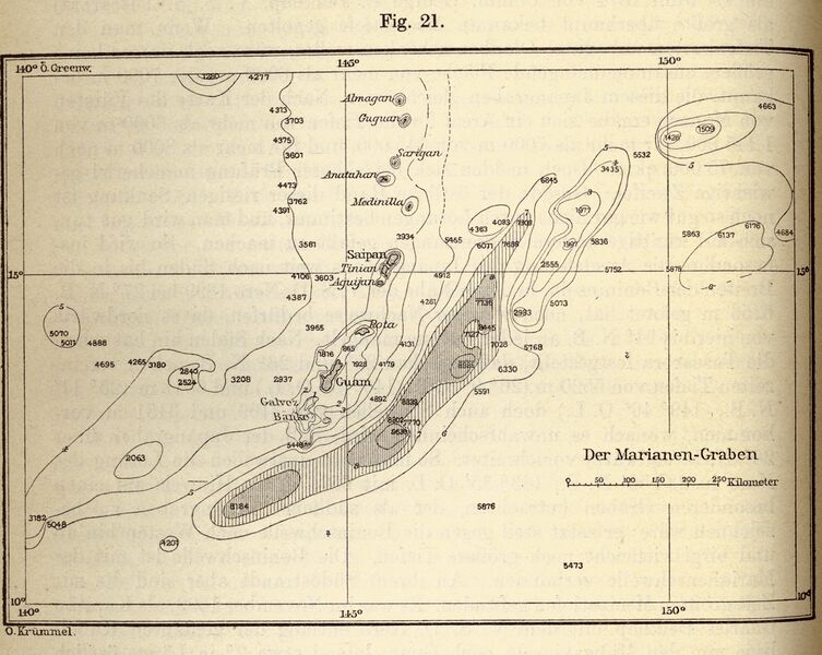
English: Otto Krummel's map of the Mariana Trench. In: "Handbuch der Ozeanographie", 1907.
Italiano: Mappa della Fossa delle Marianne da: Otto Krummel, "Handbuch der Ozeanographie", 1907.
|
| ⧼wm-license-information-date⧽ | 1907 |
| ⧼wm-license-information-source⧽ | http://www.photolib.noaa.gov/htmls/map00052.htm |
| ⧼wm-license-information-author⧽ | Otto Krummel |
| ⧼wm-license-information-permission⧽ (⧼wm-license-information-permission-reusing-text⧽) |
ترخيص

|
تاريخ الملف
اضغط على زمن/تاريخ لرؤية الملف كما بدا في هذا الزمن.
| زمن/تاريخ | صورة مصغرة | الأبعاد | مستخدم | تعليق | |
|---|---|---|---|---|---|
| حالي | ★ مراجعة معتمدة 15:15، 30 نوفمبر 2023 | | 2٬915 × 2٬321 (2٫48 ميجابايت) | Pastakhov (نقاش | مساهمات) | Upload https://upload.wikimedia.org/wikipedia/commons/a/a6/Mariana_Trench_Map_1907.jpg |
لا يمكنك استبدال هذا الملف.
وصلات
لا يوجد صفحات تصل لهذه الصورة.