ملف:Mapa topográfico del Perú.png
حجم هذه المعاينة: 423 × 600 بكسل. البعد الآخر: 500 × 709 بكسل.
الملف الأصلي (500 × 709 بكسل حجم الملف: 428 كيلوبايت، نوع MIME: image/png)
وصف قصير
| ⧼wm-license-information-description⧽ |
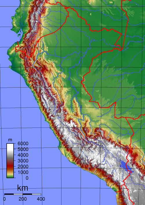
Español: Mapa topográfico del Perú creado con GMT. English: Topographic map of Peru. Created with GMT from GLOBE data.
|
| ⧼wm-license-information-date⧽ | 2012 |
| ⧼wm-license-information-source⧽ | ⧼Wm-license-own-work⧽ |
| ⧼wm-license-information-author⧽ | Maulucioni basado en un trabajo previo de Sadalmelik |
| ⧼wm-license-information-other-versions⧽ |
ترخيص
|
تاريخ الملف
اضغط على زمن/تاريخ لرؤية الملف كما بدا في هذا الزمن.
| زمن/تاريخ | صورة مصغرة | الأبعاد | مستخدم | تعليق | |
|---|---|---|---|---|---|
| حالي | ★ مراجعة معتمدة 19:41، 14 أكتوبر 2023 | | 500 × 709 (428 كيلوبايت) | Pastakhov (نقاش | مساهمات) | Upload https://upload.wikimedia.org/wikipedia/commons/d/d0/Mapa_topogr%C3%A1fico_del_Per%C3%BA.png |
لا يمكنك استبدال هذا الملف.
وصلات
لا يوجد صفحات تصل لهذه الصورة.