ملف:Map showing the location of Playa del Rey, Los Angeles.png

حجم هذه المعاينة: 800 × 522 بكسل. البعد الآخر: 1٬766 × 1٬152 بكسل.
الملف الأصلي (1٬766 × 1٬152 بكسل حجم الملف: 2٫76 ميجابايت، نوع MIME: image/png)
وصف قصير
| ⧼wm-license-information-description⧽ |
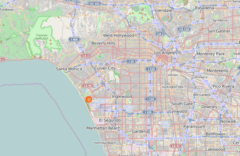
English: Map showing the location of Playa del Rey, which is a neighborhood in the City of Los Angeles.
|
| ⧼wm-license-information-date⧽ | 2014 |
| ⧼wm-license-information-source⧽ | http://www.openstreetmap.org/node/150971893#map=11/33.9901/-118.3454 |
| ⧼wm-license-information-author⧽ | © OpenStreetMap contributors |
ترخيص
تاريخ الملف
اضغط على زمن/تاريخ لرؤية الملف كما بدا في هذا الزمن.
| زمن/تاريخ | صورة مصغرة | الأبعاد | مستخدم | تعليق | |
|---|---|---|---|---|---|
| حالي | ★ مراجعة معتمدة 16:12، 10 نوفمبر 2023 | | 1٬766 × 1٬152 (2٫76 ميجابايت) | Pastakhov (نقاش | مساهمات) | Upload https://upload.wikimedia.org/wikipedia/commons/3/30/Map_showing_the_location_of_Playa_del_Rey%2C_Los_Angeles.png |
لا يمكنك استبدال هذا الملف.
وصلات
لا يوجد صفحات تصل لهذه الصورة.