ملف:Map of Tripolitana.png

حجم هذه المعاينة: 800 × 543 بكسل. البعد الآخر: 918 × 623 بكسل.
الملف الأصلي (918 × 623 بكسل حجم الملف: 38 كيلوبايت، نوع MIME: image/png)
| ⧼wm-license-information-description⧽ |
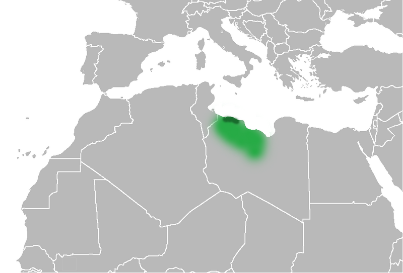
English: Map of the historical Tripolitania region (in present day northwestern Libya and northeastern Tunisia) and the historical Ottoman-Italian-early Independence state/province (within present day Libya).
|
| ⧼wm-license-information-date⧽ | 2010-06-13 08:56 (UTC) |
| ⧼wm-license-information-source⧽ | |
| ⧼wm-license-information-author⧽ |
|
| [This is a retouched picture, which means that it has been digitally altered from its original version. Modifications: Change selection of areas. The original can be viewed here: Ottoman_Provinces_Of_Present_day_Libyapng.png. Modifications made by Felitsata.] Error: {{Lang}}: text has italic markup (help)
|
قالب:Original upload log
This image is a derivative work of the following images:
- File:United_States_of_North_Africa_Locator.png licensed with PD-self
- 2010-03-26T13:53:08Z Roxanna 1160x1056 (29795 Bytes) {{Information |Description={{en|1="United States of North Africa" (proposal by President [[en:Habib Bourguiba]] for Tunisia, Algeria and Libya 1973) and "Arab Islamic Republic" (proposal by [[en:Muammar al-Gaddafi]] for a uni
- File:Ottoman_Provinces_Of_Present_day_Libyapng.png licensed with PD-self
تاريخ الملف
اضغط على زمن/تاريخ لرؤية الملف كما بدا في هذا الزمن.
| زمن/تاريخ | صورة مصغرة | الأبعاد | مستخدم | تعليق | |
|---|---|---|---|---|---|
| حالي | ★ مراجعة معتمدة 13:26، 6 أكتوبر 2023 | | 918 × 623 (38 كيلوبايت) | Pastakhov (نقاش | مساهمات) | Upload https://upload.wikimedia.org/wikipedia/commons/8/87/Map_of_Tripolitana.png |
لا يمكنك استبدال هذا الملف.
وصلات
لا يوجد صفحات تصل لهذه الصورة.